
Wandkaarten van landen - Ierland
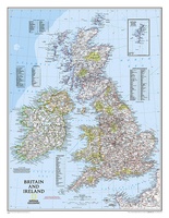 Wandkaart Britain and Ireland - Groot Brittannië en Ierland, 60 x 76 cm | National Geographic
This classic-style map of England and Wales shows political boundaries, major highways and roads, cities and towns, airports, and other geographic details. Thousands of place-names and exact borders are carefully …
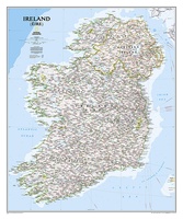 Wandkaart Ireland – Ierland, 76 x 91 cm | National Geographic
National Geographic Maps' new Ireland wall map is one of the most authoritative maps yet published of the Emerald Isle. Of the nearly 1,000 place-names shown on this map, all …
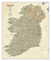 Wandkaart Ierland, antiek, 76 x 92 cm | National Geographic
National Geographic Maps' new Ireland wall map is one of the most authoritative maps yet published of the Emerald Isle. Of the nearly 1,000 place-names shown on this map, all …
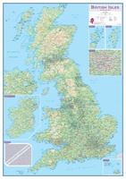 Wandkaart Engeland - British Isles roadplanning wall map, 84 X 119 cm | Maps International
Routeplanner map from Maps International's selection of British Isles maps. Routeplanning map details: British Isles routeplanning map shows the motorways, major roads and transport hubs such as airports and …
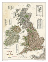 Wandkaart Groot Brittannië en Ierland antiek, 60 x 76 cm | National Geographic
This map of Britain and Ireland shows country boundaries, thousands of place names, major roadways, airports, bodies of water, and more. Rich earth-toned colors, astounding detail and boardroom quality make …
★★★★★
Laatste reviews

Zoals altijd een prima gids van Cicerone, in feite onmisbare gids voor hiken in dit gebied. De gids bevat verschillende dagtochten van ± 1 tot …
★★★★★ door Pieter Boddaert 16 mei 2024 | Heeft dit artikel gekocht
Heel blij met de kaart geweest, uiteindelijk wel 5 keer per dag in handen gehad tijdens mijn tocht. Gebruikersvriendelijk en dankzij platsificeering ook uiterst geschickt …
★★★★★ door Jasmin 16 mei 2024 | Heeft dit artikel gekocht
Snelle levering
★★★★★ door Pierre 16 mei 2024 | Heeft dit artikel gekocht
Snelle levering
★★★★★ door Pierre Dilissen 16 mei 2024 | Heeft dit artikel gekocht