
Wandkaarten van landen - Azië
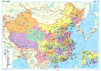 Wandkaart China – political, 95 x 69 cm | Gizi Map
Een wandkaart van China waarop de politieke grenzen en steden tweetalig staan weergeven. Natuurkundige aspecten zijn weggelaten, maar dat komt de politieke en bestuurlijke indeling duidelijk ten goede. Afmetingen: 69cm.x …
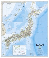 Wandkaart Japan, 63 x 74 cm | National Geographic
This classic-style map of Japan shows political boundaries, major highways and roads, cities and towns, airports, and other geographic details. Thousands of place-names and exact borders are carefully researched by …
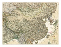
 Wandkaart China, 76 x 59 cm | National Geographic
Decoratieve wandkaart van China. Naast de mooie kleuren staan er bijzonder veel plaatsen op vermeld. Het gaat soms een beetje ten kosten van de schoonheid van de kaart, maar daardoor …
★★★★★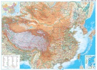 Wandkaart China – geografisch, 120 x 88 cm | Gizi Map
Prachtige wandkaart van China, waarbij zowel de politieke natuurkundige aspecten goed zichtbaar zijn. In rood zijn de belangrijkste toeristische hoogtepunten ingetekend. Kleurgebruik is vrij fel, maar daardoor wordt het geheel …
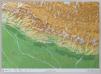 Reliëfkaart - Wandkaart Nepal 3D | GeoRelief
Prachtig vormgegeven wandkaart van Nepal met reliëf. Uitgevoed in stevig kunststof is Nepal vanzelfsprekend een land dat zich bij uitstek leent voor een 3D kaart: zo komen de bergmassieven, maar …
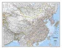
 Wandkaart China, antiek, 76 x 59 cm | National Geographic
This detailed political map of China accurately shows locations of provincial boundaries, cities and towns, major highways and roads, rivers and waterways, and other geographic features.
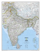 Wandkaart India, 60 x 77 cm | National Geographic
See India as only National Geographic can depict it. This new reference map is one of the most detailed and comprehensive ever published for India and southern Asia. It includes …
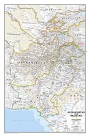 Wandkaart Afghanistan & Pakistan, 55 x 83 cm | National Geographic
This is the latest and most detailed map of the region - a perfect complement for following today's news stories. Afghanistan's 34 administrative provinces and Pakistan's provinces and territorial boundaries …
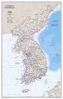 Wandkaart Korean Peninsula Noord- en Zuid Korea, 59 x 91 cm | National Geographic
Amid increasingly combative rhetoric from Pyongyang, North Korea, do you know where its underground nuclear test site or missile launch centers are located? Are you aware that the South Korean …
Laatste reviews

Mooie gedetailleerde kaart, duidelijk leesbaar, stevig, met handig plastic hoesje en extra boekje met tips en tochten.
★★★★★ door Chris 13 mei 2024 | Heeft dit artikel gekocht
Handige kaart, duidelijk leesbaar en up-to-date. Stevig en met mooi plastic hoesje en extra boekje met tips.
★★★★★ door Chris 13 mei 2024 | Heeft dit artikel gekocht
Prima gids. We hebben er veel plezier van.
★★★★★ door Edith Idzerda-Koch 13 mei 2024 | Heeft dit artikel gekocht
Met deze kaart heb je een week wandelplezier, of eventueel een dagje fietsen, op Elba
★★★★★ door Bas 13 mei 2024 | Heeft dit artikel gekocht