
Philip's Maps
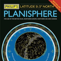 Sterrenkaart - Planisfeer Planisphere (Latitude 51. 5 North) | Philip's Maps
The first thing that every stargazer needs - an hour-by-hour and night-by-night map of the stars they'll see · A really useful bit of kit...a map of the night sky …
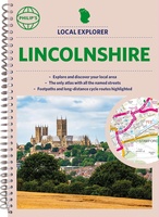 Wegenatlas Local Explorer Street Atlas Lincolnshire | Philip's Maps
Who hasn't explored and enjoyed their surrounding area recently and come to appreciate what is on our respective doorsteps? Philip's have created this new series for walkers, cyclists and local …
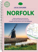 Wegenatlas Local Explorer Street Atlas Norfolk | Philip's Maps
Who hasn't explored and enjoyed their surrounding area in recent years and come to appreciate what is on our respective doorsteps? Philip's have created this new series for walkers, cyclists …
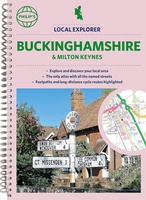 Wegenatlas Local Explorer Street Atlas Buckinghamshire and Milton Keynes | Philip's Maps
Philip's created this new series for walkers, cyclists and local explorers at a scale that provides greener options to uncover all the nature and hidden gems in your local area. …
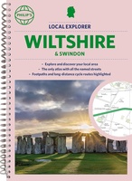 Wegenatlas Local Explorer Street Atlas Wiltshire and Swindon | Philip's Maps
Who hasn't explored and enjoyed their surrounding area in recent years and come to appreciate what is on our respective doorsteps? Philip's have created this new series for walkers, cyclists …
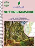 Wegenatlas Local Explorer Street Atlas Nottinghamshire | Philip's Maps
Philip's created this new series for walkers, cyclists and local explorers at a scale that provides greener options to uncover all the nature and hidden gems in your local area. …
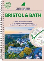 Wegenatlas Local Explorer Street Atlas Bristol and Bath | Philip's Maps
Who hasn't explored and enjoyed their surrounding area recently and come to appreciate what is on our respective doorsteps? Philip's have created this new series for walkers, cyclists and local …
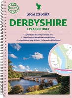 Wegenatlas Local Explorer Street Atlas Derbyshire and the Peak District | Philip's Maps
Who hasn't explored and enjoyed their surrounding area in recent years and come to appreciate what is on our respective doorsteps? Philip's have created this new series for walkers, cyclists …
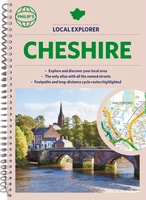 Wegenatlas Local Explorer Street Atlas Cheshire | Philip's Maps
Who hasn't explored and enjoyed their surrounding area recently and come to appreciate what is on our respective doorsteps? Philip's have created this new series for walkers, cyclists and local …
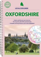 Wegenatlas Local Explorer Street Atlas Oxfordshire | Philip's Maps
Who hasn't explored and enjoyed their surrounding area in recent years and come to appreciate what is on our respective doorsteps? Philip's have created this new series for walkers, cyclists …
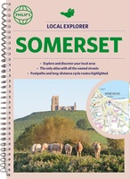 Wegenatlas Local Explorer Street Atlas Somerset | Philip's Maps
Prachtige wegenatlas van Somerset voor fietsers en wandelaars op een super gedetaileerde schaal! Met Lange afstandsfietsroutes en wandelroutes. Who hasn't explored and enjoyed their surrounding area recently and come …
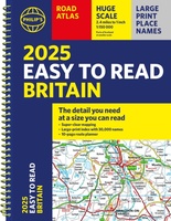
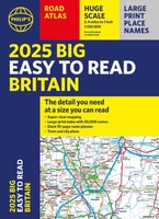 Wegenatlas Philip's Easy to Read Road Atlas of Britain 2025 | A3-Formaat | Paperback | Philip's Maps
With the detail you need at a size you can read, the latest edition of 2025 Philip's Big Easy to Read Road Atlas of Britain is super-clear, super-sized and bang …
 Wegenatlas Big Atlas Britain & Ireland 2023 A3-Formaat | Philip's Maps
Goede gedetailleerde wegenatlas van Groot-Brittannië, schaal 1:200.000 met een overzichtskaart van Ierland, schaal 1:1.000.000. Groot formaat, A3, en in ringband. Philip's is No. 1 in the UK for clear maps …
★★★★★ Wegenkaart - landkaart Orkney Shetland | Philip's Maps
Whether it's the outstanding natural beauty, ancient sites or an activity-packed break calling you, the Philip's leisure and tourist map of Orkney and Shetland is all you need. Places of …
 Wegenkaart - landkaart The Cotswolds | Philip's Maps
A new edition of this double-sided map of the Cotswolds clearly featuring places of tourist and historic interest in an easy-to-read style of mapping, alongside six handy town centre plans. …
 Wegenatlas Local Explorer Street Atlas Devon | Philip's Maps
Prachtige wegenatlas van Devon voor fietsers en wandelaars op een super gedetaileerde schaal! Philip's created this new series for walkers, cyclists and local explorers at a scale that provides …
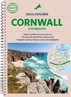 Wegenatlas Local Explorer Street Atlas Cornwall and Plymouth | Philip's Maps
Prachtige wegenatlas van Cornwall voor fietsers en wandelaars op een super gedetaileerde schaal! Met Lange afstandsfietsroutes en wandelroutes. Who hasn't explored and enjoyed their surrounding area recently and come …
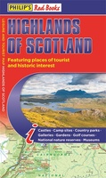 Wegenkaart - landkaart Highlands of Scotland | Philip's Maps
Zeer duidelijke wegenkaart van het noorden van Schotland. This leisure and tourist map of the Highlands of Scotland gives detailed coverage of the area's road network at a scale of …
 Wegenatlas Philip's Easy to Read Road Atlas of Britain 2025 | A4-Formaat | Ringband | Philip's Maps
"The detail you need at a size you can read". The latest 2025 Philip's Easy to Read Road Atlas of Britain from the best-selling Road Atlas range has over 350 …
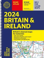 Wegenatlas Road Atlas Britain and Ireland 2024 | Philip's Maps
PHILIP'S - Market leaders and No. 1 in the UK for clear maps'Good balance between detail and clarity with excellent town maps' What Car? * Super-clear mapping at a scale …
★★★★★
Laatste reviews

Vorig jaar al stuk in Denemarken gefietst. Dat smaakte naar meer. Dus nu de nog ontbrekende kaart aangeschaft. Dit zijn perfecte kaarten om op te …
★★★★★ door Nicolette Kroon 14 mei 2024 | Heeft dit artikel gekocht
kaart voldoet aaan hetgeen we nodig hebben . goeed overzicht door de kleuren en hoogte meters en vooral tekst groote voor onze aankomende fietsreis
★★★★★ door marc verschueren 13 mei 2024 | Heeft dit artikel gekocht
Mooie gedetailleerde kaart, duidelijk leesbaar, stevig, met handig plastic hoesje en extra boekje met tips en tochten.
★★★★★ door Chris 13 mei 2024 | Heeft dit artikel gekocht
Handige kaart, duidelijk leesbaar en up-to-date. Stevig en met mooi plastic hoesje en extra boekje met tips.
★★★★★ door Chris 13 mei 2024 | Heeft dit artikel gekocht