
Collins
Maak je reis compleet met de handige reisgidsen en wegenkaarten van Collins
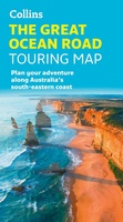 Wegenkaart - landkaart Touring Maps The Great Ocean Road | Collins
Full color, informative map of the popular Great Ocean Road. With detailed mapping, key tourist information and a suggested itinerary, this is a perfect guide for anyone traveling around Australia’s …
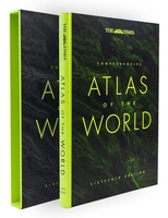 Atlas The Times Comprehensive Atlas of the World | Collins
De moeder aller atlassen in een nieuwe druk. Als je al een atlas wilt kopen, bezuinig dan niet en doe deze: veruit de beste meest complete atlas in een prachtige …
★★★★★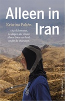 Reisverhaal Alleen in Iran | Kristina Palten
Ze deed het onmogelijke: hardlopend Iran doorkruisen Kristina Paltén is mid-dertig als haar wereld instort: haar relatie loopt stuk, ze verliest haar baan en krijgt ook nog te horen dat …
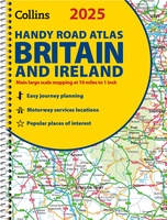 Wegenatlas 2025 Collins Handy Road Atlas Britain and Ireland | Collins
Handzame A5 wegenatlas van Engeland, Wales, Schotland en Ierland met register en stadsplattegronden This easy-to-use, handy A5 sized road atlas with popular lie-flat spiral binding features extremely clear route planning …
★★★★★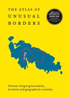 Reisgids - Reisverhaal Atlas of Unusual Borders | Zoran Nikolic
The world is not always what we think it is. This book presents unusual borders, enclaves and exclaves, divided or non-existent cities and islands. Numerous conflicts have left countries divided …
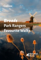 Wandelgids Park Rangers Favourite Walks Broads | Collins
The perfect companions for exploring the National Parks. Walking guide to the Broads National Park, with 20 best routes chosen by the park rangers. Each walk varies in length from …
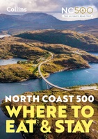 Reisgids - Accommodatiegids North Coast 500 | Collins
A guide to the best places to enjoy the local Scottish cuisine and where to rest for the night along the famous North Coast 500. Elemental, enchanting and inspiring, the …
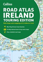 Wegenatlas Road Atlas Ireland | Collins
Explore Ireland with this accurate and fully updated road atlas. This road atlas is at A4 size, covering the whole of Ireland and features clear and detailed Collins colour mapping …
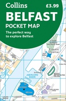 Stadsplattegrond Pocket Map Belfast | Collins
Handige kleine stadsplattegrond van Belfast. Handy little full color Collins map of central Belfast with a high level of detail. Clear mapping from Cliftonville in the north to Botanics …
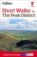 Wandelgids Short Walks in the Peak District | Collins
A brand new range of practical little walk guides endorsed by the Ramblers. All the walks are 5 miles or under in length and can easily be completed in less …
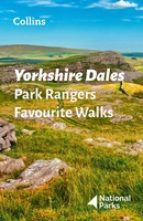 Wandelgids Park Rangers Favourite Walks Yorkshire Dales | Collins
Compacte wandelgids met 20 wandelingen geselecteerd door park rangers en met duidelijke beschrijvingen en routekaartjes. Walking guide to the Yorkshire Dales National Park, with 20 best routes chosen by …
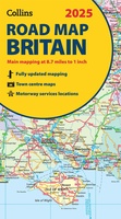 Wegenkaart - landkaart Road Map of Britain 2025 | Collins
Full-colour, double-sided road map of Great Britain at a scale of 8.7 miles to 1 inch. Northern England, Scotland and the Isle of Man are on one side with Southern …
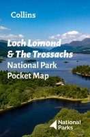 Wegenkaart - landkaart National Park Pocket Map Loch Lomond and the Trossachs | Collins
Handige kleine kaart van dit Nationaal Park. De kaart geeft een goed en helder overzicht van het gebied met alle plaatsen, doorgaande wandelpaden (alhoewel grof van schaal), bezienswaardigheden etc. Met …
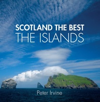 Reisgids Scotland the Best the Islands | Collins
See Scotland's remarkable islands from a new perspective in this beautiful guide curated by celebrated Scotland the Best author, Peter Irvine. Featuring images from acclaimed Scottish and international photographers accompanied …
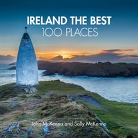 Reisgids Ireland The Best 100 Places | Collins
Sally and John McKenna, travel and food writers and authors of IRELAND THE BEST, have selected 100 extraordinary places that epitomise what is truly great about Ireland. This personal and …
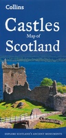 Wegenkaart - landkaart Castles map of Scotland - Schotland kastelen | Collins
Kaart waarop meer dan 700 kastelen in Schotland staan aangegeven. Explore Scotland’s ancient monuments with this pictorial map featuring over 700 castles and fortified houses. Includes an easy-to-use index listing …
★★★★★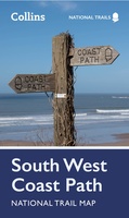 Wandelkaart National Trail Map South West Coast Path | Collins
Overzichtskaart op vrij grove schaal van deze LAW Lange Afstands Wandeling in Engeland. Let op: je kunt er niet op lopen. Wel met veel informatie op de kaart, goed ingetekend, …
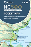 Wegenkaart - landkaart Pocket Map NC500 | Collins
Handy little full colour map of the popular North Coast 500 route. A perfect guide for travelling around Northern Scotland. Detailed mapping and tourist information ideal for any road trip. …
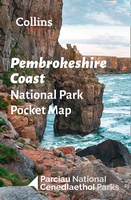 Wegenkaart - landkaart National Park Pocket Map Pembrokeshire Coast | Collins
Duidelijke pocket wandelkaart met belangrijke toeristische informatie, bezienswaardigheden, campeerplekken e.d. Handy little full colour map and guide of Pembrokeshire Coast National Park. Detailed mapping and visitor information to the National …
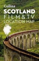 Wegenkaart - landkaart Pocket Map Scotland Film and TV Location Map | Collins
Full-colour, handy guide to more than 60 of the most popular film and TV locations in Scotland. Striking images and detailed descriptions allow for a comprehensive guide to Scotland's most …
Laatste reviews

Mooie gedetailleerde kaart, duidelijk leesbaar, stevig, met handig plastic hoesje en extra boekje met tips en tochten.
★★★★★ door Chris 13 mei 2024 | Heeft dit artikel gekocht
Handige kaart, duidelijk leesbaar en up-to-date. Stevig en met mooi plastic hoesje en extra boekje met tips.
★★★★★ door Chris 13 mei 2024 | Heeft dit artikel gekocht
Prima gids. We hebben er veel plezier van.
★★★★★ door Edith Idzerda-Koch 13 mei 2024 | Heeft dit artikel gekocht
Met deze kaart heb je een week wandelplezier, of eventueel een dagje fietsen, op Elba
★★★★★ door Bas 13 mei 2024 | Heeft dit artikel gekocht