
Collins
Maak je reis compleet met de handige reisgidsen en wegenkaarten van Collins
 Wegenkaart - landkaart Jamaica | Collins
Detailed, up-to-date, full colour road map of the whole of Jamaica from the countries national mapping agency. Includes tourist sites, points of interest and maps of major towns and resort …
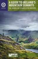 Wandelgids A Guide to Ireland's Mountain Summits | Collins
For the first time a list of the 500+ meter mountains of Ireland is published, along with lists of Ireland's 27 County High Points and the island's Hundred Highest mountains, …
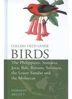 Vogelgids Birds of the Philippines, Sumatra, Java, Bali, Borneo, Sulawesi, the Lesser Sundas and the Moluccas | Collins
This comprehensive new field guide is an excellent addition to the world-renowned series – the ultimate reference book for travelling birdwatchers. Every species of bird you might encounter in …
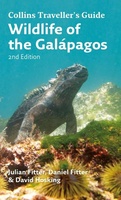 Natuurgids Wildlife of the Galapagos | Collins
Since its first publication more than a decade ago, Wildlife of the Galápagos has become the definitive, classic field guide to the natural splendors of this amazing part of the …
★★★★★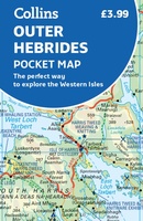 Wegenkaart - landkaart Pocket Map Outer Hebrides | Collins
Explore new places with handy pocket maps from Collins. Handy little full-colour map of the Western Isles of Scotland. Detailed mapping and tourist information for the islands of Lewis, Harris, …
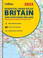
★★★★★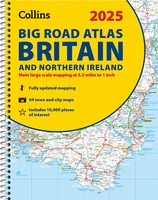 Wegenatlas Big Road Atlas Britain and Northern Ireland 2025 | A3 | Ringband | Collins
Grote wegenatlas, a3-formaat in ringband. The ultimate 3.2 miles to 1 inch scale large-format, spiral-bound road atlas of Britain, featuring Collins’ popular and well established road mapping, and designed for …
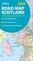 Wegenkaart - landkaart Scotland - Schotland road map 2025 | Collins
Explore Scotland with easy-to-read mapping from Collins. Full-color map of Scotland at 8.7 miles to 1 inch (1:550.000), with clear road network and administrative areas shown in color. The map …
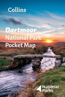 Wegenkaart - landkaart National Park Pocket Map Dartmoor | Collins
Handige kleine kaart van dit Nationaal Park. De kaart geeft een goed en helder overzicht van het gebied met alle plaatsen, doorgaande wandelpaden (alhoewel grof van schaal), bezienswaardigheden etc. Met …
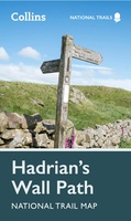 Wandelkaart National Trail Map Hadrian’s Wall Path | Collins
Overzichtskaart op vrij grove schaal van deze LAW Lange Afstands Wandeling in Engeland. Let op: je kunt er niet op lopen. Wel met veel informatie op de kaart, goed ingetekend, …
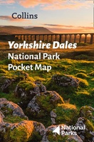 Wegenkaart - landkaart National Park Pocket Map Yorkshire Dales | Collins
Handige kleine kaart van dit Nationaal Park. De kaart geeft een goed en helder overzicht van het gebied met alle plaatsen, doorgaande wandelpaden (alhoewel grof van schaal), bezienswaardigheden etc. Met …
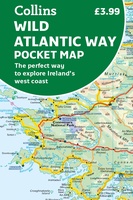 Wegenkaart - landkaart Pocket Map Wild Atlantic Way | Collins
Handy full-colour map of Ireland’s Wild Atlantic Way with a high level of detail. Clear mapping of the full 2500 km (over 1500 miles) route, showing the road network and …
★★★★★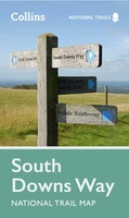 Wandelkaart National Trail Map South Downs Way | Collins
Overzichtskaart op vrij grove schaal van deze LAW Lange Afstands Wandeling in Engeland. Wel met veel informatie op de kaart, goed ingetekend, een route-schema op de achterzijde en een beschrijving …
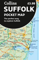 Wegenkaart - landkaart Pocket Map Suffolk | Collins
Explore new places with handy pocket maps from Collins. Handy little full-colour map of county of Suffolk. Detailed mapping, photographs, and tourist information. Famed for its archaeological finds, swathes …
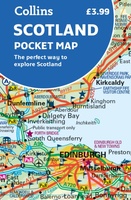 Wegenkaart - landkaart Pocket Map Scotland | Collins
Handy little full colour map of Scotland. Excellent value and very detailed for its size. Double-sided folded map with the Central Belt, southern Scotland and northern England on one side …
 Wegenatlas Essential Road Atlas Britain 2025 | A4 | Ringband | Collins
This A4 road atlas with lie-flat spiral binding provides clear and detailed road mapping for England, Wales and Southern Scotland at a scale of 3.2 miles to 1 inch (1:200,000). …
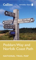 Wandelkaart National Trail Map Peddars Way and Norfolk Coast | Collins
Overzichtskaart op vrij grove schaal van deze LAW Lange Afstands Wandeling in Engeland. Let op: je kunt er niet op lopen. Wel met veel informatie op de kaart, goed ingetekend, …
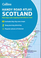 Wegenatlas Handy Road Atlas Scotland - Schotland | Collins
Handzame A% wegenatlas van Schotland met register en stadsplattegronden. Discover new places with handy road atlases from Collins. Your ideal companion for navigating around Scotland. It has extremely clear, route …
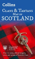 Historische Kaart Scotland Clans and Tartans Map | Collins
Prachtige kaart van Schotland waarin duideljk wordt welke cland er zijn geweest en nog zijn. Met een mooi overzicht van alle Tartans (Stoffen) die er aan gekoppeld zijn. Discover …
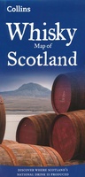 Wegenkaart - landkaart Whisky map of Scotland | Collins
Wegenkaart met meer dan 100 distilleerderijen en whisky gerelateerde locaties. Discover where Scotland’s national drink is produced. All of Scotland’s operational whisky distilleries and whisky-related places of interest located …
★★★★★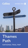 Wandelkaart National Trail Map Thames Path | Collins
Overzichtskaart op vrij grove schaal van deze LAW Lange Afstands Wandeling in Engeland. Let op: je kunt er niet op lopen. Wel met veel informatie op de kaart, goed ingetekend, …
- 1
- 2
- 3
- Volgende >>
- 6
Laatste reviews

Vorig jaar al stuk in Denemarken gefietst. Dat smaakte naar meer. Dus nu de nog ontbrekende kaart aangeschaft. Dit zijn perfecte kaarten om op te …
★★★★★ door Nicolette Kroon 14 mei 2024 | Heeft dit artikel gekocht
kaart voldoet aaan hetgeen we nodig hebben . goeed overzicht door de kleuren en hoogte meters en vooral tekst groote voor onze aankomende fietsreis
★★★★★ door marc verschueren 13 mei 2024 | Heeft dit artikel gekocht
Mooie gedetailleerde kaart, duidelijk leesbaar, stevig, met handig plastic hoesje en extra boekje met tips en tochten.
★★★★★ door Chris 13 mei 2024 | Heeft dit artikel gekocht
Handige kaart, duidelijk leesbaar en up-to-date. Stevig en met mooi plastic hoesje en extra boekje met tips.
★★★★★ door Chris 13 mei 2024 | Heeft dit artikel gekocht