
Kaarten - Lowlands | Schotse Laaglanden en grenzen
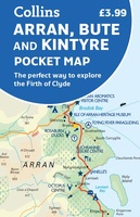 Wegenkaart - landkaart Pocket Map Arran, Bute and Kintyre | Collins
Handy little full colour map of Arran, Bute and Kintyre. Main features of this map include: • Clear mapping • Main tourist attractions located and described • Ideal for …
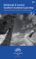 Fietskaart 24 Cycle Maps UK Edinburgh - Central Southern Scotland | Cordee
Een nieuwe fietskaarten serie van Groot-Brittannië. Gedrukt op scheur- en watervast papier en mooi handzaam klein formaat. Deze kaarten zijn met name heel goed om de Lange Afstands Fietsroutes (LF) …
★★★★★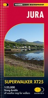 Wandelkaart Jura - Schotland | Harvey Maps
Shows the Paps of Jura and includes 1 Corbett and 2 Grahams. This detailed map for hillwalkers shows the whole of the Isle of Jura at the popular 1:25,000 …
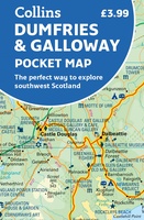 Wegenkaart - landkaart Pocket Map Dumfries & Galloway | Collins
Handy little full colour map of Dumfries & Galloway. Main features of this map include: • Clear mapping • Main tourist attractions located and described • Ideal for touring …
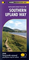 Wandelkaart Southern Upland Way | Harvey Maps
Southern Upland Way is Britain's first official coast to coast long distance footpath and is one of Scotland's Great Trails. It runs 340km (212 miles) from Portpatrick on the south …
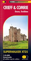 Wandelkaart Crieff & Comrie, Doune, Dunblane | Harvey Maps
Map covers the Munro, Ben Chonzie, popular Glen Artney, as well as the Braes of Doune and Doune Castle, which has featured in various film and television shows, such as …
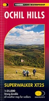 Wandelkaart Ochil Hills | Harvey Maps
Superwalker is designed to be the most practical tool for navigation outdoors. The format gives more mapping on the sheet without making the map heavy and bulky. The fold has …
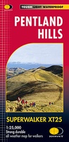 Wandelkaart Pentland Hills | Harvey Maps
The whole of the Pentlands on one side of one sheet. More than a map, an essential piece of equipment this new generation HARVEY Superwalker is designed to be the …
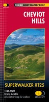 Wandelkaart Cheviot Hills | Harvey Maps
Includes the Cheviot, Newton Tors and Kirknewton. Detailed map for hillwalkers and cyclists of the Cheviot Hills at 1:25,000 scale. Includes the northern section of the Pennine Way from Brownhart …
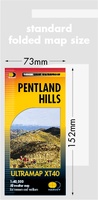 Wandelkaart Pentland Hills | Harvey Maps
Covers a large area yet is handily compact. Pocket perfect!Detailed map for runners and walkers of the whole of the Pentlands at the magic scale of 1:40,000 on one side …
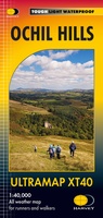 Wandelkaart Ochil Hills | Harvey Maps
Pocket perfect! Well known hills are Dumyat, Ben Cleuch and Castle Craig Hill. Magnificent views over the Forth Valley. Places of interest and enlargements of the steep and narrow glens: …
 Wandelkaart Arran | Harvey Maps
Covers a large area yet is handily compact. Pocket perfect! Features the renowned Goat Fell, A'Chir ridge, Beinn Bharrain, Glen Sannox & Glen Rosa. Detailed map for runners …
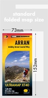
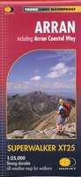 Wandelkaart Arran including Arran Coastal Way | Harvey Maps
Een bijzonder handige kaart van dit gebied. Op waterafstotend papier met veel details. Features the renowned Goat Fell, A'Chir ridge, Beinn Bharrain, Glen Sannox & Glen Rosa. Detailed map …
★★★★★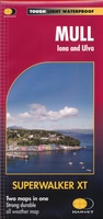 Wandelkaart Mull - Iona - Ulva | Harvey Maps
Zeer duidelijke kaart van Mull, met o.a. hoogtelijnen en geschikt voor gebruik met GPS.Two maps in one! 1:25,000 scale walking map of the mountains of Mull with a recreation …
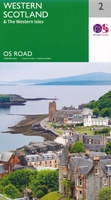 Wegenkaart - landkaart 2 OS Road Map Western Scotland & the Western Isles | Ordnance Survey
Een serie uitstekende wegenkaarten van Ordnance survey, de topografische dienst van Engeland. Alle 8 delen kennen een schaal van 1:250.000. Het kleurgebruik is uitbundig maar niet storend; integendeel, de hoogtes …
★★★★★ Wegenkaart - landkaart 3 OS Road Map Southern Scotland & Northumberland | Ordnance Survey
Een serie uitstekende wegenkaarten van Ordnance survey, de topografische dienst van Engeland. Alle 8 delen kennen een schaal van 1:250.000. Het kleurgebruik is uitbundig maar niet storend; integendeel, de hoogtes …
★★★★★★★★★★
Laatste reviews

Kan de huidige ontstuimige ontwikkelingen wereldwijd, nu ook geografisch plaatsen en daarmee beter volgen.
★★★★★ door Leo Janssen 20 december 2024 | Heeft dit artikel gekocht
We hadden Piëmonte al eens bezocht en voor onze komende reis werd ons door kennissen deze gids aanbevolen. Inderdaad is dit een heel goede gids. …
★★★★★ door DWKdB 19 december 2024 | Heeft dit artikel gekocht
Mijn bestellingen zijn altijd goed en worden altijd op tijd geleverd. Komen afspraken goed na. Erg tevreden.
★★★★★ door Ben Wegdam 19 december 2024 | Heeft dit artikel gekocht
Zeer gedetailleerde kaart van het zuidelijke deel van het douaniers pad
★★★★★ door Marian 18 december 2024 | Heeft dit artikel gekocht