Kaarten - Schotland
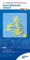 Wegenkaart - landkaart Groot-Brittanië en Ierland | ANWB Media
De ANWB heeft een grote serie wegenkaarten van de belangrijkste landen en streken. Het zijn echte overzichtskaarten van vaak een wat groter gebied. Deze keuze zorgt er voor dat de …
★★★★★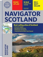 Wegenatlas Navigator Scotland | A4-Formaat | Ringand | Philip's Maps
Duidelijke en gedetailleerde atlas van Schotland met enkele stadsplattegronden en register. Zuid Schotland is van schaal 1:100.000 en het noorden met schaal 1:200.000 Philip's Navigator Scotland is part of …
★★★★★ Wegenkaart - landkaart 501 Schotland | Michelin
Zoals je van Michelin mag verwachten zijn het onmisbare overzichtskaarten van een uitstekende kwaliteit: een duidelijk en goed leesbaar kaartbeeld. Vrijwel alle berijdbare wegen staan er op ingetekend, in kleur …
★★★★★★★★★★ Wandelkaart Speyside Walk (Schotland) | Harvey Maps
Een bijzonder handige kaart van dit lange-afstands-wandelpad van 144 km. Op waterafstotend papier met veel details, uitstekend en voldoende voor deze route. A leap forward in technical excellence: Tough, durable …
 Wegenkaart - landkaart Great Britain - Engeland - Schotland | ITMB
Een degelijke kaart met aanduidingen van o.a. nationale parken, vliegveld, benzinepomp, dirt-roads en kleine plattegrond van hoofdstad. Als overzichtskaart goed te gebruiken. This is the third set of …
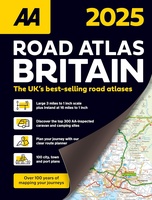 Wegenatlas Road Atlas Britain 2025 - A4 | AA Publishing
Wegenatlas, met spiraal, van Groot-Brittannie, Engeland, Wales en Schotland, met toeristische informatie This top-selling road atlas showcases Britain’s clearest mapping from the experts at the AA at a large 3.2 …
★★★★★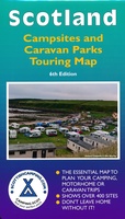 Camperkaart - Campinggids Scotland Campsites and Caravan Parks - Touring map | Scottishcamping.com
Dit soort kaarten zouden ze voor elk land moeten maken: heel duidelijk weergegeven vind je hier alle campings in Schotland op de voorzijde en op de achterzijde de adressen en …
 Wegenkaart - landkaart 9 Road Map Britain Scotland - Schotland | AA Publishing
Goede dubbelzijdige wegenkaart van Schotland met plaatsnamen index. Britain’s clearest mapping from the experts at the AA, in a handy foldable map. Fully updated, this map of Scotland combines clear …
★★★★★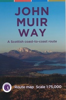 Wandelkaart John Muir Way | SNH
Geplastificeerde kaart van de John Muir Way in Schotland, 215 km van Helensburg naar Dunbar. De route staat goed ingetekend op deze kaart.
★★★★★ Wegenkaart - landkaart Great Britain & Ireland - Groot Brittannië & Ierland | Marco Polo
Duidelijke wegenkaart van Marco Polo: alle wegen, zowel de verharde als belangrijke onverharde wegen zijn weergegeven. Mooie toeristisch interessante wegen die de moeite waard zijn, zijn groen gearceerd. Veel toeristische …
 Wandelkaart Affric Kintail Way | Harvey Maps
Mooie, duidelijke kaart van de Affric Kintail way in Schotland. Geplastificeerd met veel extra informatie en uitsnedes van de route. De hele rote op 1 kaart, erg handig! The Affric …
★★★★★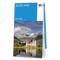 Wegenkaart - landkaart 12 Tour Map Scotland | Ordnance Survey
If you are on holiday and looking for a simple map containing all the information you need to make the most of your visit, the Tour maps are for you. …
★★★★★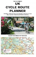 Fietskaart The Ultimate UK Cycle Route Planner | Excellent Books
Fully updated and revised 4th edition for 2022 with an increased sheet size. One of the best selling UK cycle publications giving an overview of all the main signed UK …
★★★★★ Wandelkaart West Highland Way | Harvey Maps
Wandelkaart van de West Highland Way met uitsnedes van de route. Leap forward in technical excellence. Tough, light and 100% wateproof. Compact and light - the map itself weighs just …
★★★★★ Wegenkaart - landkaart - Stadsplattegrond Edinburgh & Southern Scotland | ITMB
Plattegrond van Edinburgh, schaal 1:10.000, met op de achterzijde een overzichtskaart van zuid Schotland, schaal 1:370.000. Legend Includes: Roads by classification, Airports, Ferry lines, Railways, Railway stations, Bus terminals, Bicycle …
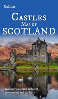 Wegenkaart - landkaart Castles map of Scotland - Schotland kastelen | Collins
Kaart waarop meer dan 700 kastelen in Schotland staan aangegeven. Discover Scotland's ancient monuments and castles. Explore Scotland’s ancient monuments with this pictorial map featuring over 700 castles and fortified …
★★★★★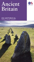 Wegenkaart - landkaart Ancient Britain | Ordnance Survey
The Ordnance Survey Ancient Britain map is a comprehensive guide to the most important archaeological sites of early English, Welsh and Scottish history. Ordnance Survey's Ancient Britain map shows Neolithic, …
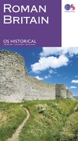 Wegenkaart - landkaart Roman Britain | Ordnance Survey
An informative map showing the location of the most important ancient monuments of Roman Britain. The map has been produced by Ordnance Survey in collaboration with the Ancient Monument Trusts …
 Wegenkaart - landkaart Whisky map of Scotland | Collins
Wegenkaart met meer dan 100 distilleerderijen en whisky gerelateerde locaties. Discover where Scotland’s national drink is produced. All of Scotland’s operational whisky distilleries and whisky-related places of interest located …
★★★★★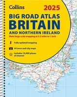 Wegenatlas Big Road Atlas Britain and Northern Ireland 2025 | A3 | Ringband | Collins
Grote wegenatlas, a3-formaat in ringband. The ultimate 3.2 miles to 1 inch scale large-format, spiral-bound road atlas of Britain, featuring Collins’ popular and well established road mapping, and designed for …
★★★★★★★★★★
- 1
- 2
- 3
- Volgende >>
- 5
Laatste reviews

Blij dat De Zwerver deze perfecte, franstalige IGN gidsen aanbiedt en dan óók met een woordenlijst erbij gevoegd. De voorbereiding kan beginnen na een vlotte …
★★★★★ door Lie van Schelven 06 januari 2025 | Heeft dit artikel gekocht
Voor een paar dagen Leipzig een prima reisgids. Het deel voor Dresden is aanmerkelijk groter maar was niet hinderlijk.
★★★★★ door J.A. Pazie 06 januari 2025 | Heeft dit artikel gekocht
Op reis in Botswana is deze kaart onmisbaar en vreselijk nuttig. Handig met tankstations. Snel thuisbezorgd.
★★★★★ door henk heeringa 06 januari 2025 | Heeft dit artikel gekocht
Zeer tevreden.
★★★★★ door R. Ahlers 06 januari 2025 | Heeft dit artikel gekocht
