
Kaarten - Ierland
 Wegenkaart - landkaart Ierland, Dublin & Belfast | ITMB
Duidelijke wegenkaart van Ierland. Met stadsplattegronden van Dublin en Belfast. Aanduidingen van benzinestations, nationale parken en bezienswaardigheden.
 Wegenatlas The Wild Atlantic Way Ierland | Xploreit Maps
Yvonne Gordon provides an essential guide to Ireland's epic coastal driving route - the Wild Atlantic Way. In this newly revised and updated edition she divides the route into 16 …
★★★★★★★★★★ Wegenkaart - landkaart Pocket Map Wild Atlantic Way | Collins
Handy full-colour map of Ireland’s Wild Atlantic Way with a high level of detail. Clear mapping of the full 2500 km (over 1500 miles) route, showing the road network and …
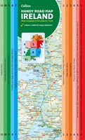
★★★★★ Wegenatlas Handy Road Atlas Ireland - Ierland | Collins
Handzame wegenatlas op A5 formaat van Ierland. Vrij grove schaal maar heel handig door formaat en goed kaartbeeld. Met enkele stadsplattegronden en een paar pagina's met hoogtepunten van het land. …
 Wegenatlas Great Britain and Ireland 2024 - Main Roads Atlas (A4-Spiral) | Michelin
Full of practical features, the Michelin Great Britain & Ireland 2024 - Main Roads Atlas (A4-Spiral) is the perfect companion for your everyday journey and holiday planning. Updated every year, …
★★★★★ Wandelkaart The Mournes | Ordnance Survey Ireland
From the rugged granite peaks of the mountains to the picturesque coastline below, the Mournes region is an Area of Outstanding Natural Beauty. This guide map has information about climbing, …
 Wegenkaart - landkaart Ireland - Ierland | AA Publishing
Folded, double-sided sheet map shows the detailed road network with toll motorways and dual carriageways identified. Includes motorway service areas, AA-inspected campsites, viewpoints and picnic sites. Gaeltacht regions are highlighted …
 Wegenkaart - landkaart Pocket Map Ireland Film and TV Location Map | Collins
Full-colour, handy guide to more than 50 of the most popular film and TV locations in Ireland. Striking images and detailed descriptions allow for a comprehensive guide to Ireland's most …
 Wegenkaart - landkaart Map of Ireland Handy | Collins
Explore new places with this comprehensive map of Ireland from Collins. An easy-to-use route-planning map covering the whole of Ireland. It has the convenience of an atlas with all the …
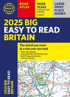 Wegenatlas Philip's Easy to Read Road Atlas of Britain 2025 | A3-Formaat | Paperback | Philip's Maps
With the detail you need at a size you can read, the latest edition of 2025 Philip's Big Easy to Read Road Atlas of Britain is super-clear, super-sized and bang …
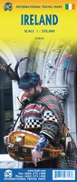 Wegenkaart - landkaart Ierland | ITMB
As technology improves, we are able to produce more detailed maps than was previously possible. Such is the case with Ireland, a part of the world consisting of two countries …
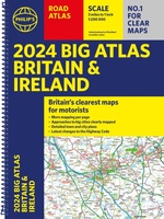 Wegenatlas Big Atlas Britain & Ireland 2023 A3-Formaat | Philip's Maps
Goede gedetailleerde wegenatlas van Groot-Brittannië, schaal 1:200.000 met een overzichtskaart van Ierland, schaal 1:1.000.000. Groot formaat, A3, en in ringband. Philip's is No. 1 in the UK for clear maps …
★★★★★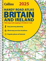 Wegenatlas 2025 Collins Handy Road Atlas Britain and Ireland | Collins
Handzame A5 wegenatlas van Engeland, Wales, Schotland en Ierland met register en stadsplattegronden This easy-to-use, handy A5 sized road atlas with popular lie-flat spiral binding features extremely clear route planning …
★★★★★ Wegenkaart - landkaart Ierland | Freytag & Berndt
Heel Ierland op zeer gedetailleerde schaal, bestaat uit een set van 3 kaarten in een plastic hoes. Een uitstekende kaart van Ierland met toeristische informatie, jachthavens, stranden, vele wandelpaden …
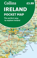 Wegenkaart - landkaart Pocket Map Ireland pocket map - Ierland | Collins
Kleine handzame kaart van Ierland. Explore Ireland with this handy, full colour map. Handy little full colour map of Ireland at an excellent price. It is double-sided, with the …
★★★★★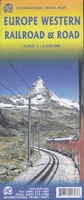 Spoorwegenkaart Europe Western Railroad & Road | ITMB
Spoorwegen kaart van West Europa in kleur. Schaal 1:2,500,000. Toont spoorlijnen, snelwegen, secundaire wegen en andere wegen, veerboten en belangrijke scheepvaartdiensten; internationale grenzen, de grenzen van de gebieden met reisbeperkingen; …
★★★★★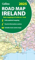 Wegenkaart - landkaart Ireland - Ierland road map 2025 | Collins
Explore Ireland with easy-to-read mapping from Collins. Full-color map of Ireland at 9 miles to 1 inch (1:570,240), with clear, detailed road network and counties and new administrative areas shown …
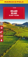 Wegenkaart - landkaart Ierland - Ireland | Marco Polo
Duidelijke wegenkaart van Marco Polo: alle wegen, zowel de verharde als belangrijke onverharde wegen zijn weergegeven. Mooie toeristisch interessante wegen die de moeite waard zijn, zijn groen gearceerd. Veel toeristische …
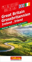 Wegenkaart - landkaart Grossbritannien, Irland - Groot Britannie, Ierland | Hallwag
Prima kaart van heel Groot Brittannie en Ierland , dubbelzijdig bedrukt met plaatsnamen index. Road map Great Britain / Ireland Road map with transit plans, location index, tourist information and …
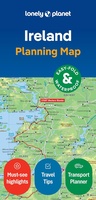 Wegenkaart - landkaart Planning Map Ireland | Lonely Planet
Durable and waterproof, with a handy slipcase and an easy-fold format, Lonely Planet's Ireland Planning Map is your essential navigation tool. This full-colour map features accompanying images and information …
- 1
- 2
- 3
- Volgende >>
- 6
Laatste reviews

Duidelijke kaart, ook met kleinere wegen. Snelle levering
★★★★★ door Ger Sulkers 02 mei 2024 | Heeft dit artikel gekocht
Ja wij zijn tevreden, alleen is mijn vriendin het boekje al kwijtgeraakt bij onze eerste wandeling.🙁
★★★★★ door Mark 02 mei 2024 | Heeft dit artikel gekocht
Ja ik ben dik tevreden over de wegenkaart van Kazachstan. Stond alles op wat ik wou dus heel erg tevreden daarover.
★★★★★ door Sjoerd Westra 02 mei 2024 | Heeft dit artikel gekocht
Zoals altijd mooie verzorgde kaarten die tijdens de reis van pas komen en achteraf mooie herinneringen oproepen.
★★★★★ door Klaas Wijnberg 02 mei 2024 | Heeft dit artikel gekocht