
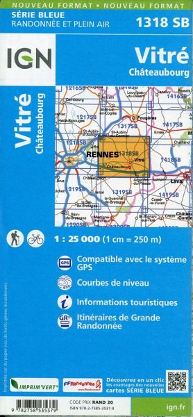
Wandelkaart - Topografische kaart 1318SB Vitré - Châteaubourg | IGN - Institut Géographique National (9782758535379)

- ISBN / CODE: 9782758535379
- Editie: meest recente versie
- Schaal: 1:25000
- Uitgever: IGN - Institut Géographique National
- Soort: Topografische kaart, Wandelkaart
- Serie: Serie bleue
- Taal: Frans
- Bindwijze: -
- Uitvoering: Papier
- Schrijf als eerste een review
-
€ 16,95
Leverbaar in 3 - 5 werkdagen in huis in Belgie Levertijd Nederland
-
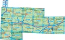
Topografische kaart IGN 25.000 Bretagne OOSTELIJK GEDEELTE

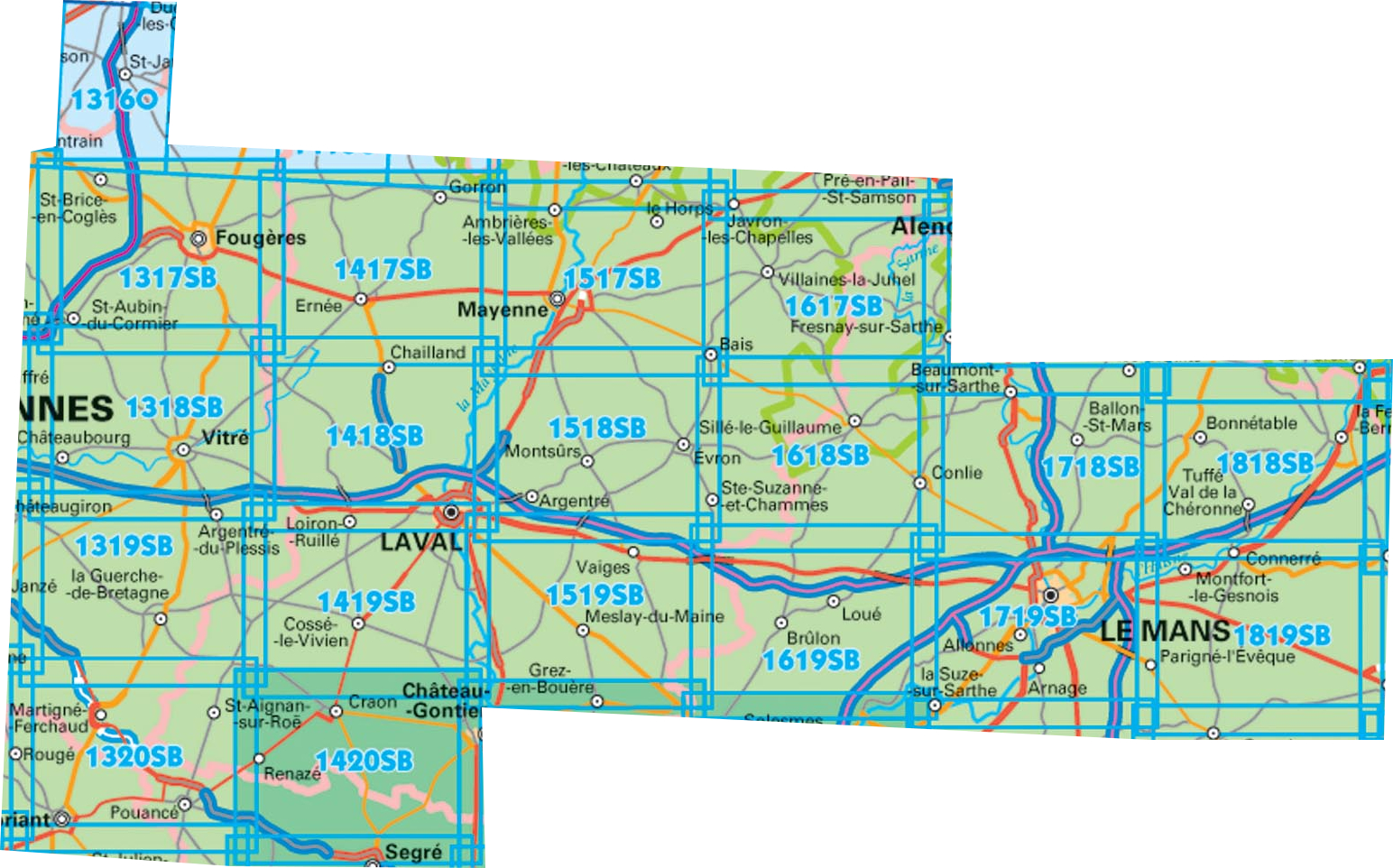
Producten op deze overzichtskaart:
Klik op een product om naar de pagina van dat product te gaan.
- Wandelkaart - Topografische kaart 1316SB St-Hilaire-du-Harcouët | IGN - Institut Géographique National
- Wandelkaart 1317SB Fougères – St-Brice-en-Coglès | IGN - Institut Géographique National
- Wandelkaart - Topografische kaart 1318SB Vitré - Châteaubourg | IGN - Institut Géographique National
- Wandelkaart - Topografische kaart 1319SB La Guerche-de-Bretagne – Retiers | IGN - Institut Géographique National
- Wandelkaart - Topografische kaart 1320SB Châteaubriant - Pouancé | IGN - Institut Géographique National
- Wandelkaart - Topografische kaart 1417SB Ernée - Gorron | IGN - Institut Géographique National
- Wandelkaart - Topografische kaart 1418SB Laval - Port-Brillet | IGN - Institut Géographique National
- Wandelkaart - Topografische kaart 1419SB Cossé-le-Vivien - L'Huisserie | IGN - Institut Géographique National
- Wandelkaart - Topografische kaart 1420SB Craon | IGN - Institut Géographique National
- Wandelkaart - Topografische kaart 1517SB Mayenne - Le Horps | IGN - Institut Géographique National
- Wandelkaart - Topografische kaart 1518SB Evron - Montsûrs | IGN - Institut Géographique National
- Wandelkaart - Topografische kaart 1519SB Meslay-du-Maine, Vaiges | IGN - Institut Géographique National
- Wandelkaart - Topografische kaart 1617SB Villaines-la-Juhel, St-Pierre-des-Nids, Alpes Mancelles | IGN - Institut Géographique National
- Wandelkaart - Topografische kaart 1618SB Sillé-le-Guillaum, Conlie Ste-Suzanne | IGN - Institut Géographique National
- Wandelkaart - Topografische kaart 1619SB Loué - Brûlon, Noyen-sur-Sarthe | IGN - Institut Géographique National
- Wandelkaart - Topografische kaart 1718SB Beaumont-sur-Sarthe - Ballon | IGN - Institut Géographique National
- Wandelkaart - Topografische kaart 1719SB Le Mans - La Suze-sur-Sarthe | IGN - Institut Géographique National
- Wandelkaart - Topografische kaart 1818SB La Ferté-Bernard | IGN - Institut Géographique National
-
Wandelkaart IGN 25.000 Bretagne OOSTELIJK GEDEELTE

Producten op deze overzichtskaart:
Klik op een product om naar de pagina van dat product te gaan.
- Wandelkaart - Topografische kaart 1316SB St-Hilaire-du-Harcouët | IGN - Institut Géographique National
- Wandelkaart 1317SB Fougères – St-Brice-en-Coglès | IGN - Institut Géographique National
- Wandelkaart - Topografische kaart 1318SB Vitré - Châteaubourg | IGN - Institut Géographique National
- Wandelkaart - Topografische kaart 1319SB La Guerche-de-Bretagne – Retiers | IGN - Institut Géographique National
- Wandelkaart - Topografische kaart 1320SB Châteaubriant - Pouancé | IGN - Institut Géographique National
- Wandelkaart - Topografische kaart 1417SB Ernée - Gorron | IGN - Institut Géographique National
- Wandelkaart - Topografische kaart 1418SB Laval - Port-Brillet | IGN - Institut Géographique National
- Wandelkaart - Topografische kaart 1419SB Cossé-le-Vivien - L'Huisserie | IGN - Institut Géographique National
- Wandelkaart - Topografische kaart 1420SB Craon | IGN - Institut Géographique National
- Wandelkaart - Topografische kaart 1517SB Mayenne - Le Horps | IGN - Institut Géographique National
- Wandelkaart - Topografische kaart 1518SB Evron - Montsûrs | IGN - Institut Géographique National
- Wandelkaart - Topografische kaart 1519SB Meslay-du-Maine, Vaiges | IGN - Institut Géographique National
- Wandelkaart - Topografische kaart 1617SB Villaines-la-Juhel, St-Pierre-des-Nids, Alpes Mancelles | IGN - Institut Géographique National
- Wandelkaart - Topografische kaart 1618SB Sillé-le-Guillaum, Conlie Ste-Suzanne | IGN - Institut Géographique National
- Wandelkaart - Topografische kaart 1619SB Loué - Brûlon, Noyen-sur-Sarthe | IGN - Institut Géographique National
- Wandelkaart - Topografische kaart 1718SB Beaumont-sur-Sarthe - Ballon | IGN - Institut Géographique National
- Wandelkaart - Topografische kaart 1719SB Le Mans - La Suze-sur-Sarthe | IGN - Institut Géographique National
- Wandelkaart - Topografische kaart 1818SB La Ferté-Bernard | IGN - Institut Géographique National
Overzichtskaarten
Beschrijving
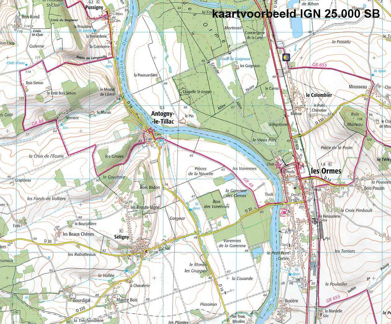
De wandelkaart die de perfectie benadert! Werkelijk alle topografische details zijn er op te vinden; van hoogtelijnen tot aan bruggetjes en allerlei wandelpaden. Daarnaast hebben de makers een flinke dosis toeristische informatie op de kaart verwerkt: campings, gites d étape en ingetekende doorgaande wandelpaden, de grandes randonnées. Het kleurgebruik is geweldig met schaduwzijdes, bos, weiland, etc goed te onderscheiden. De kaart is uitgevoerd met raster van graden, dus deze is GPS - toepasbaar!
De TOP 25 kaarten (kaart nummers die eindigen op "T") hebben betrekking op gebieden van bijzonder toeristisch belang zoals de Alpen, de Pyreneeën,De Cevennes, de Vogezen, de Provence, en de Atlantische en Middellandse zeekusten. De kaarten hebben een opdruk en benadrukken zo de lokale wandelpaden, lange afstand GR routes en, in voorkomend geval, ski routes. Andere toeristische informatie omvat campings, paardensport of kanocentra, hutten, berghutten, etc. Elke "TOP 25" kaart bedekt een gebied van ongeveer 28 x 21 km.
Reviews
Geen reviews gevonden voor dit product.
Schrijf een review
Graag horen wij wat u van dit artikel vindt. Vindt u het goed, leuk, mooi, slecht, lelijk, onbruikbaar of erg handig: schrijf gerust alles op! Het is niet alleen leuk om te doen maar u informeert andere klanten er ook nog mee!
Ook interessant voor europa/frankrijk/bretagne
-
 | Michelin")
Wegenkaart - landkaart 308 Finistere
€ 9,95Wegenkaarten Bretagne -

Wandelgids 247 Bretagne | Rother Ber
€ 17,50Wandelgidsen Bretagne -

Campergids 10 Mit dem Wohnmobil in d
€ 26,50Campergidsen Bretagne -

Wandelkaart - Topografische kaart 10
€ 16,95Topografische kaarten Bretagne -

Reisgids ANWB extra Bretagne | ANWB
€ 15,50Reisgidsen Bretagne