
Kaarten - ♦ Cotswolds AONB
 Wandelkaart - Topografische kaart 163 Landranger Cheltenham & Cirencester, Stow-on-the-Wold - Cotswolds | Ordnance Survey
Zeer goede detailkaart met topografische ondergrond. Kleurgebruik is goed over nagedacht: bijzonder goed leesbaar en helder kaartbeeld. Hierop zijn toeristische symbolen van bezienswaardigheden ingetekend, daarnaast staan bijvoorbeeld campings en jeugdherbergen …
★★★★★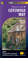 Wandelkaart Cotswold Way | Harvey Maps
Mooie, duidelijke kaart van de Cotswold Way in Engeland. Geplastificeerd met veel extra informatie en uitsnedes van de route. A leap forward in technical excellence: Tough, durable and 100% …
★★★★★ Wegenkaart - landkaart 6 OS Road Map Wales & West Midlands | Ordnance Survey
Een serie uitstekende wegenkaarten van Ordnance survey, de topografische dienst van Engeland. Alle 8 delen kennen een schaal van 1:250.000. Het kleurgebruik is uitbundig maar niet storend; integendeel, de hoogtes …
★★★★★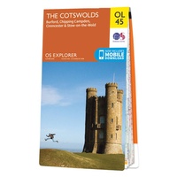 Wandelkaart - Topografische kaart OL45 OS Explorer Map The Cotswolds | Ordnance Survey
Met zijn 4cm voor 1 km (2 ½ cm voor 1 mijl) schaal, is de OS Outdoor Leisure kaartenserie de ideale en meest gedetailleerde kaartenreeks voor mensen die graag outdoor-activiteiten …
★★★★★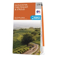 Wandelkaart - Topografische kaart 179 OS Explorer Map Gloucester, Cheltenham, Stroud | Ordnance Survey
The essential map for outdoor activities in Gloucester, Cheltenham and Stroud. The OS Explorer Map is the Ordnance Survey's most detailed folding map and is recommended for anyone enjoying outdoor …
★★★★★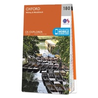 Wandelkaart - Topografische kaart 180 OS Explorer Map Oxford | Ordnance Survey
Met zijn 4cm voor 1 km (2 ½ cm voor 1 mijl) schaal, is de OS Explorer kaartenserie de ideale en meest gedetailleerde kaartenreeks voor mensen die graag outdoor-activiteiten zoals …
 Wandelatlas Adventure Atlas Cotswold Way | A-Z Map Company
The A-Z Adventure Series of maps is the perfect companion for walkers, off-road cyclists, and anyone wishing to explore the great outdoors. The Cotswold Way is a 102 mile …
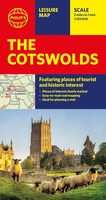 Wegenkaart - landkaart The Cotswolds | Philip's Maps
A new edition of this double-sided map of the Cotswolds clearly featuring places of tourist and historic interest in an easy-to-read style of mapping, alongside six handy town centre plans. …
 Wegenkaart - landkaart Cotswolds map and guide | Goldeneye
Detailkaart op schaal 1:126.000 van de Cotswolds. Veel detail, met veel symbolen worden ook de toeristische hoogtepunten weergegeven. This was the first publication I produced. A Map-Guide close to my …
★★★★★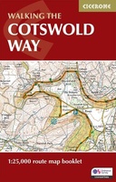 Wandelkaart Walking the Cotswold Way | Cicerone
Handzaam gidsje met alleen de topografische routekaarten van 1:25000. De uitgebreide wandelgids (inclusief dit gidsje) is hier te bestellen. All the mapping you need to complete the Cotswold Way National …
 Wandelkaart South Cotswold Classic Walks | Goldeneye
Explore the south Cotswolds with this laminated, waterproof Cotswolds walking map. With 10 circular, clearly-marked routes this easy-to-use map will help you discover the Cotswolds via some of the finest …
 Wegenkaart - landkaart Planning Map Oxford & the Cotswolds | Lonely Planet
Durable and waterproof, with a handy slipcase and an easy-fold format, Lonely Planet's Oxford & the Cotswolds Planning Maphelps you get around with ease. Get more from your map …
 Wegenkaart - landkaart Pocket Map Cotswolds | Collins
Handy little full colour map of the Cotswolds. Main features of this map include: • Clear mapping • Main tourist attractions located and described • Ideal for touring with …
 Wandelkaart North Cotswold Classic Walks | Goldeneye
With 10 circular, clearly-marked routes this easy-to-use map will help you discover the Cotswolds via some of the finest pubs and tearooms. Step into the Cotswolds with these exceptionally …
 Fietskaart 08 Tour Map The Cotswolds & Gloucestershire | Ordnance Survey
De Ordnance Survey Tour Maps met schaal 1:100.000 zijn uitstekend geschikt om zelf je fietsvakantie te plannen in Engeland. Ze laten alle alle grote en kleinere wegen zien. Bovendien staan …
★★★★★
Laatste reviews

Niet echt voor beginners. Ook zijn de routes soms moeilijk qua logistiek. Weer terugkomen aan het eind bv. En in voorseizoen (mei) blijft er niet …
★★★★★ door Tjeerd 17 mei 2024 | Heeft dit artikel gekocht
Van te voren had ik een andere kaart op het oog. Toen ik in de winkel was adviseerde zij mij deze kaart. Op hun verzoek …
★★★★★ door Koen 17 mei 2024 | Heeft dit artikel gekocht
Ideale schaal waar ook de kleinere wegen duidelijk zijn aangegeven. Beschrijving op website is correct.
★★★★★ door Peter 16 mei 2024 | Heeft dit artikel gekocht
Overzichtelijke kaart. Niks op aan te merken.
★★★★★ door Bastiaan de Leeuw 16 mei 2024 | Heeft dit artikel gekocht