
♦ Yorkshire Dales Nationaal Park
 Wandelgids Noord-Engeland | Uitgeverij Elmar
De 60 mooiste wandelingen in Noord-Engeland, met het lake District, de Yorkshire Dales en Northumberland. Zoals gebruikelijk zijn er verschillende wandelingen voor beginnende en ervaren wandelaars en is er onmisbare …
★★★★★ Wandelkaart Yorkshire 3 Peaks Challenge Map | Discovery Walking Guides
Goede scheur- en watervaste wandelkaart. OS 50k scale mapping is doubled in size to produce a 25k map but the features, text and logos are now doubled in size making …
 Wandelkaart Pennine Way South | Harvey Maps
Mooie, duidelijke kaart van het zuidelijke gedeelte van de Pennine Way (Edale to Middleton-in-Teesdale). The whole of the Pennine Way on just 2 maps! Pennine Way South map covers …
 Fietskaart mountainbike Coast to Coast WEST | Harvey Maps
Deze kaart toont het westelijke deel van de route tussen St Bees/Ravenglass en Kirkby Stephen/Aysgarth via Ambleside/Windermere. Er zijn meerdere alternatieve routes ingetekend op een duidelijke topografische ondergrond. De …
 Fietskaart mountainbike Coast to Coast OOST | Harvey Maps
Deze kaart toont het oostelijke deel van de route tussen Kirkby Stephen/Aysgarth en Robin Hood's Bay/Ravenscar via Richmond/Osmotherley. Er zijn meerdere alternatieve routes ingetekend op een duidelijke topografische ondergrond. …
 Fietsgids Cycling in the Yorkshire Dales | Cicerone
This guide describes 23 day routes, graded by a combination of distance, climb and overall gradient, all suitable for road bikes and illustrated by detailed maps and profiles. In addition …
 Wandelgids The Dales Way | Rucksack Readers
This charming walk runs for 79 miles (127 km) from Ilkley in the Yorkshire Dales to Bowness in the Lake District. The route heads north through Wharfedale, crisscrossing the river, …
 Wandelgids England Nord - Engeland Noord | Rother Bergverlag
Uitstekende wandelgids met 60 dagtochten. Met praktische informatie en beperkt kaartmateriaal! Wandelingen in verschillende zwaarte weergegeven in rood/blauw/zwart. Deze wandelgidsen uitgever staat hoog aangeschreven en is een begrip onder de …
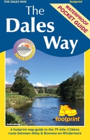 Wandelkaart The Dales Way | Footprint maps
Handzame wandelkaart voor de Dales Way in Noord Engeland. The Dales Way is a 79 mile (127km) long distance trail in the north of England, running between Ilkley, in North …
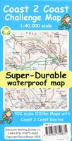 Wandelkaart Coast 2 Coast | Discovery Walking Guides
Goede scheur- en watervaste wandelkaart. The whole Coast 2 Coast on one double sided, 960mm by 694mm, map sheet. All 193 miles (308 kilometres) of the Wainwright route along with …
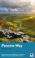
★★★★★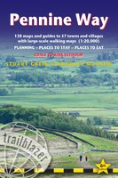 Wandelgids Pennine Way | Trailblazer Guides
Trailblazer British Walking Guide to the Pennine Way, Britain's best-known National Trail that winds for 256 miles through three National Parks - the Peak District, Yorkshire Dales and Northumberland. This …
★★★★★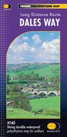 Wandelkaart Dales Way | Harvey Maps
Mooie, duidelijke kaart van de Dales Way in Noord-Engeland. Geplastificeerd met veel extra informatie en uitsnedes van de route. A leap forward in technical excellence: Tough, durable and 100% …
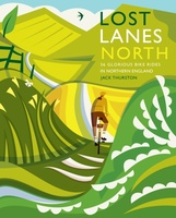 Fietsgids Lost Lanes North | Wild Things Publishing
Jack Thurston, best-selling author of the Lost Lanes series (50,000 sold) and presenter of the Bike Show, takes you on a freewheeling tour of the lost lanes and forgotten byways …
 Wandelgids Pennine Way | Aurum Press
Goede beschrijving van de aantrekkelijke route. Kaartmateriaal van Ordnance Survey - de Engelse topografische dienst op een schaal van 1:25.000. Praktische info voor overnachten ed. niet altijd uitgebreid, maar die …
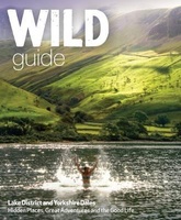 Reisgids Lake District and Yorkshire Dales | Wild Things Publishing
Imagine a summer spent swimming in mountain waterfalls, exploring lost ruins and caverns, and camping in ancient forests. In this explorer's compendium you will discover the most exciting and lesser-known …
★★★★★ Wandelatlas The Dales Way Map Booklet | Cicerone
Heel handig bedacht van uitgever Cicerone: een boekje dat dienst doet als atlas met alle topografische kaarten die je nodig hebt voor het lopen van de Dales Way. Past goed …
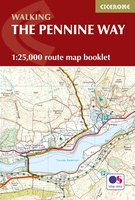 Wandelatlas Pennine Way Map Booklet | Cicerone
Heel handig bedacht van uitgever Cicerone: een boekje dat dienst doet als atlas met alle topografische kaarten die je nodig hebt voor het lopen van de Pennine Way. Past goed …
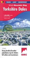 Wandelkaart Yorkshire Dales | Harvey Maps
A huge area on one map. Yorkshire Dales - the latest addition to the British Mountain Map series - is the sixth title in this highly successful & innovative range. …
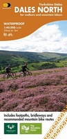 Fietskaart Dales Noord | Harvey Maps
Detailed map with off-road cycle routes. GPS compatible. Rights of Way. Large area on a compact sheet. Yorkshire Dales North covers Swaledale and Wensleydale, including Keld, Hawes, Aysgarth and Leyburn.
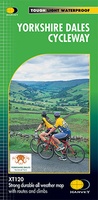 Fietskaart Yorkshire Dales Cycleway | Harvey Maps
The entire cycle route on one sheet. The route is circular, starting and ending in Skipton, with an alternative start/end in Ilkley. The cycle map includes a route profile. Steep …
Laatste reviews

Pieterpad had sowieso mijn interesse, fietsroutes daaromheen des te meer. Artikelen zijn leuk opgesteld, de routes zelf zijn met de knooppunten goed te doen. Aanbevelenswaardig.
★★★★★ door Gijs 08 juni 2024 | Heeft dit artikel gekocht
Snelle levering. Altijd goed
★★★★★ door Elisabeth De Groot 07 juni 2024 | Heeft dit artikel gekocht
Mooi boekje met looproutes waarbij veel bezienswaardigheden zijn aangegeven en veel tips wat accomodatie betreft.
★★★★★ door Paulien 07 juni 2024 | Heeft dit artikel gekocht
Mooie kaart in de juiste schaal
★★★★★ door Ben van der Meer 07 juni 2024 | Heeft dit artikel gekocht