West Midlands
 Wandelgids 080 Pathfinder Guides Shropshire | Ordnance Survey
Fraaie, goed verzorgde wandelgidsjes met 28 wandelingen van max. een dag, (beginnend bij korte, eindigend bij langere wandelingen). Weergegeven op duidelijke topografische kaartjes (1:25.000). Bevat verder wetenswaardigheden en praktische informatie …
 Wandelgids 074 Pathfinder Guides The Malverns to Warwickshire | Ordnance Survey
Discover 28 beautiful walks across The Malverns to Warwickshire with the OS Pathfinder Guidebooks, graded by length and ranging from 3 to 9 miles - ideal for both holidaymakers and …
 Wandelgids 073 Pathfinder Guides More Peak District | Ordnance Survey
This companion to the Pathfinder Peak District Guidebook contains 28 additional circular walks of 3 to 10.5 miles. Like the main book, each is graded length difficulty, and ranger from …
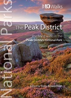 Wandelgids Peak District | Northern Eye Books
Klein, handzaam wandelgidsje met wandelingen in het Peak District. Met goede kaartjes van Ordnance Survey. Discover the very best of the Peak District. These ten themed walks explore the …
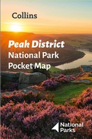 Wegenkaart - landkaart National Park Pocket Map Peak District | Collins
Handige kleine kaart van dit Nationaal Park. De kaart geeft een goed en helder overzicht van het gebied met alle plaatsen, doorgaande wandelpaden (alhoewel grof van schaal), bezienswaardigheden etc. Met …
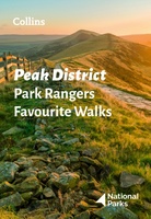 Wandelgids Park Rangers Favourite Walks Peak District | Collins
The perfect companions for exploring the National Parks. Walking guide to the Peak District National Park, with 20 best routes chosen by the park rangers. Each walk varies in length …
★★★★★ Wandelgids 15 Short Walks Malvern Hills | Cicerone
Julia Goodfellow-Smith has chosen 15 of the best short walks in the Malvern Hills for you to explore. Our guide comes with easy-to-read Ordnance Survey maps and clear route descriptions, …
 Reisgids 111 places in Places in Birmingham That You Shouldn't Miss | Emons
Welcome to Birmingham, a super-diverse city with an ever-shifting identity. This is the quiet mediaeval market town that overnight became the centre of the industrial revolution, over the centuries rolling …
 Reisgids 111 places in Places in Coventry That You Shouldn't Miss | Emons
The ultimate insider's guide to Coventry Features interesting and unusual places not found in traditional travel guides Part of the international 111 Places/111 Shops series with over 650 titles and …
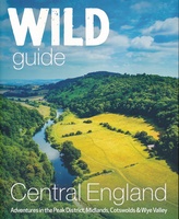 Reisgids Central England - Centraal Engeland | Wild Things Publishing
Prachtige reisgids van Centraal Engeland waarbij nadrukkelijk de natuur en buitensportmogelijkheden worden uitgelicht. Met kaarten en wat praktische informatie. A new compendium of adventures, from the best-selling Wild Guide series …
 Wandelgids Walking the Shropshire Way | Cicerone
This is the official guide to the Shropshire Way, which consists of a northern and southern loop that both start in Shrewsbury. Each loop can be completed in a week …
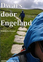 Reisverhaal Dwars door Engeland | Martijn van Rijsbergen
We willen een reis maken. Mijn Vriendin en ik. Op avontuur. We kunnen de hele wereld kiezen, het wordt Groot-Brittannië. Een verslag van een reis over één van de oudste, …
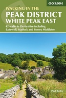 Wandelgids Walking in the Peak District - White Peak East | Cicerone
Uitstekende wandelgids van het Peak District van de gerenommeerde uitgever Cicerone. This guidebook provides 35 day walks and 7 longer walks and trails exploring the eastern section of Derbyshire's …
★★★★★ Reisgids Michelin groene gids Noord-Engeland/Wales | Lannoo
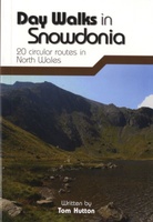 Wandelgids Day Walks in Snowdonia | Vertebrate Publishing
Day Walks in Snowdonia showcases 20 circular routes, between 5.5 and 12 miles (9km and 19km) in length, suitable for hillwalkers of all abilities. Additionally included in a Bonus Section …
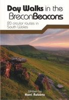 Wandelgids Day Walks in the Brecon Beacons | Vertebrate Publishing
Day Walks in the Brecon Beacons features 20 circular routes between 6.8 and 16.5 miles (11km and 16.6km) in length, suitable for hill walkers of all abilities. Local author and …
 Fietskaart 4 Tour Map Peak district & Derbyshire | Ordnance Survey
De Ordnance Survey Tour Maps met schaal 1:100.000 zijn uitstekend geschikt om zelf je fietsvakantie te plannen in Engeland. Ze laten alle alle grote en kleinere wegen zien. Bovendien staan …
★★★★★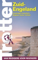 Reisgids Trotter Zuid Engeland | Lannoo
Veel aandacht voor praktische informatie als hotels en restaurants, maar ook beschrijvingen van bezienswaardigheden. Handig zijn de vele plattegronden: verrassend en verfrissend geschreven! Geen foto's. Een must voor elke reiziger …
 Wandelkaart Cannock Chase | Harvey Maps
New 1:25,000 scale map of this popular area in the West Midlands. Ideal for walking, mountain biking and other outdoor activities. Made with support from the Cannock Chase Area of …
 Wandelkaart Malvern Hills | Harvey Maps
Shows the whole of the ridge from North Malvern to Whiteleaved Oak, including the Herefordshire and Worcestershire Beacons. Detailed map for walkers, cyclists and horseriders of the Malvern Hills …
Laatste reviews

Dit boek is zeker aan te bevelen als informatie boek over Albanië. Misschien dat er een paar plaatsen ontbreken, maar het is leuker te lezen …
★★★★★ door José 29 oktober 2024 | Heeft dit artikel gekocht
Ik ben zeker tevreden over mijn aankoop. Mooie kaart en vlot geleverd. Zelf ben ik al vele malen op Ameland geweest en weet hoe belangrijk …
★★★★★ door Carina 29 oktober 2024 | Heeft dit artikel gekocht
Mooie kaart en vlot geleverd. Zelf ben ik al vele malen op Ameland geweest en weet hoe belangrijk een goede kaart is voor fietsroutes en …
★★★★★ door Carina 29 oktober 2024 | Heeft dit artikel gekocht
Zeer uitgebreid. Niet alleen de wandelingen maar ook informatie over bushaltes en parkeerplaatsen. Na bestelling snel geleverd.
★★★★★ door Peter 26 oktober 2024 | Heeft dit artikel gekocht


