
Wandelgidsen - Wales
 Wandelgids Brecon Beacons | Ordnance Survey
Get outside and enjoy ten short leisurely strolls across the Brecon Beacons National Park, indulging in wonderful mountain views across Southern Britain’s hilliest terrain. With routes for all abilities, enjoy …
 Wandelgids Walking the Pembrokeshire Coast Path | Cicerone
Engelstalige beschrijving van een mooie wandeltocht in Wales. De gids voldoet aan alle verwachtingen die je kunt hebben. Met apart gidsje met prima wandelkaarten. This guidebook describes the Pembrokeshire Coast …
★★★★★ Wandelgids 34 Pathfinder Guides Pembrokeshire & Carmarthenshire | Ordnance Survey
Wandelgids van een deel van Wales. Deze gids bevat 28 dagwandelingen, variërend van korte tochten tot pittige dagtochten. De bijbehorende kaarten zijn uitstekend: men heeft de topografische kaarten van Ordnance …
★★★★★ Wandelgids Pembrokeshire Coast Path Wales, St. Dogmaels to Amroth | Aurum Press
Beschrijving van de route langs de kust van Zuidwest Wales. Historische en culturele aspecten komen vrij uitgebreid aan bod, praktische informatie is wel summier. Kaartmateriaal zonder meer uitstekend! The Pembrokeshire …
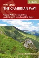 Wandelgids The Cambrian Way | Cicerone
Uitstekende wandelgids van de Cambrian Way, waarbij naast alle noodzakelijke informatie ook gebruik gemaakt wordt van de echte topografische kaart. Dubbed 'the mountain connoisseurs' walk', the Cambrian Way stretches 479km …
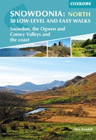 Wandelgids Snowdonia: North - Low-level and easy walks | Cicerone
This guidebook describes 30 low level and easy walks that are suitable for all abilities. The hikes covered are in the northern part of Snowdonia National Park, close to Conwy, …
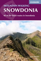 Wandelgids Mountain walking Snowdonia | Cicerone
Uitstekende wandelgids voor dit uitdagende wandelgebied in Wales. 38 dagtochten en een tweedaagse tocht. This guidebook describes 40 day walks exploring Snowdonia. It showcases some of the best mountain walks …
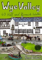 Wandelgids Wye Valley | Pocket Mountains
This guide contains forty circular routes, covering an area somewhat broader than the AONB but within similar north-south boundaries. This collection of walks is split into five areas: Hereford Lowlands …
 Wandelgids Wildlife Walks | Bloomsbury
The definitive guide to Britain's stunning wildlife heritage, showcasing more than 475 walks through the Wildlife Trust's forest, heaths, moors and woods. Published in conjunction with the Wildlife Trusts, …
 Wandelgids Carmarthenshire | Pocket Mountains
Handige compacte wandelgids met 40 dagwandelingen. Deze gids bevat kleine kaartjes en leuke uitgebreide informatie over wat er langs de route te zien is. Goede wandelkaarten zijn echter we noodzakelijk …
 Wandelgids Wales Coast Path: Pembrokeshire | Northern Eye Books
Official Guide: Wales Coast Path: Pembrokeshire One of seven Official Guides to the Wales Coast Path The 186 mile/300km long Pembrokeshire section of the Wales Coast Path runs …
 Wandelgids Wales Coast Path Carmarthen Bay & Gower | Northern Eye Books
Official Guide: Wales Coast Path: Carmarthen Bay & Gower One of seven Official Guides to the Wales Coast Path The Carmarthen Bay and Gower section of the Wales …
 Wandelgids Wales Coast Path: Snowdonia and Ceredigion | Northern Eye Books
Official Guide: Wales Coast Path: Snowdonia & Ceredigion Coast One of seven Official Guides to the Wales Coast Path This Official Guide to the Snowdonia & Ceredigion Coast section of …
 Wandelgids Snowdonia | Rockfax
This new book by Mark Reeves covers all the best mountain walks and scrambles in and around the Snowdonia area. The coverage is done in full Rockfax style with bigh …
 Wandelgids Walking The End to End Trail | Cicerone
Een droomroute voor velen: helemaal van het zuidelijkste puntje van Engeland naar het noordelijkste puntje van Schotland, zo'n slordige 1956 km door fabelachtig mooie afwisselende landschappen. Zeer gedetailleerd beschreven met …
 Wandelgids Walking the Pembrokeshire Coast Path map booklet | Cicerone
A booklet of all the mapping needed to walk the Pembrokeshire Coast Path National Trail between Amroth near Tenby and St Dogmaels by Cardigan. Covering 290km (180 miles) and over …
 Accommodatiegids - Wandelgids The Book of the Bothy | Cicerone
A celebration of 26 of the author's favourite bothies, as she shares her memories of her favourite 'stone tents' all over the UK in remote and wild locations. Packed with …
 Wandelgids Best Day Walks Great Britain - Groot Brtittanië | Lonely Planet
Lonely Planet heeft een nieuwe serie uitgebracht: Best Day Walks in verschillende landen. Het zijn de - door Lonely Planet uitgekozen - mooiste wandelingen verspreid over het land. Goed beschreven, …
 Wandelgids Snowdonia Slate Trail | Rucksack Readers
The Snowdonia Slate Trail is a waymarked trail that runs for 83 miles from Bangor on the North Wales coast, making a circuit through the heart of Snowdonia to end …
 Wandelgids Day Walks Classic Day Walks in England & Wales | Vertebrate Publishing
Classic Day Walks in England & Wales features a selection of 20 of the best day-length hillwalking routes from Vertebrate Publishing's popular series of walking guidebooks. Edited by Jon Barton, …
Laatste reviews

Zoals altijd een prima gids van Cicerone, in feite onmisbare gids voor hiken in dit gebied. De gids bevat verschillende dagtochten van ± 1 tot …
★★★★★ door Pieter Boddaert 16 mei 2024 | Heeft dit artikel gekocht
Heel blij met de kaart geweest, uiteindelijk wel 5 keer per dag in handen gehad tijdens mijn tocht. Gebruikersvriendelijk en dankzij platsificeering ook uiterst geschickt …
★★★★★ door Jasmin 16 mei 2024 | Heeft dit artikel gekocht
Snelle levering
★★★★★ door Pierre 16 mei 2024 | Heeft dit artikel gekocht
Snelle levering
★★★★★ door Pierre Dilissen 16 mei 2024 | Heeft dit artikel gekocht