Mandje Tel: +31503126950 Menu
Winkelwagen
Geen items in winkelwagen
Ga naar winkelwagen

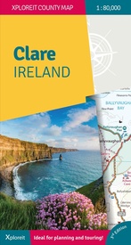
Wegenkaart - landkaart - Fietskaart Clare (Ierland) | Xploreit Maps (9781738413607)

  • ISBN / CODE: 9781738413607
  • Editie: 25-06-2024
  • Druk: 3
  • Aantal blz.: 1
  • Schaal: 1:80000
  • Uitgever: Xploreit Maps
  • Soort: Fietskaart, Wegenkaart
  • Taal: Engels
  • Hoogte: 25.0 cm
  • Breedte: 13.0 cm
  • Dikte: 1.0 cm
  • Gewicht: 99.0 g
  • Uitvoering: Scheur- en watervast
  • Bindwijze: -
  • Beoordeling: 5,0 ★★★★★ (2 reviews) Schrijf een review
  • 23,50

    Op voorraad. Binnen 2 - 3 werkdagen in huis in Belgie Levertijd Nederland Voor 17.00 uur op werkdagen besteld, binnen 1 tot 2 werkdagen in huis in Nederland Levertijd Belgie

    Gratis verzending in Nederland vanaf €35,-

Beschrijving

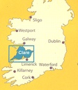
Mooie geplastificeerde en scheurvaste kaart van de County Clare met index.

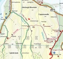
This Xploreit map is an essential companion for your next trip to County Clare. Whatever your location in the county, a quick scan of the map will reveal all the local attractions including the best drives, cycle routes and walks in the area.  It is fully revised and now includes the Clare section of the long-distance Euro Velo Atlantic Cycle Route. From Loop Head, with its famous lighthouse, you can follow West Clare’s wild and rugged coast as it rises to the spectacular Cliffs of Moher and meets The Burren, the unique limestone pavement of the northern uplands. East Clare has numerous walking and sightseeing opportunities also, with Lough Derg and Slieve Bernagh as highlights. Convenient and informative, this touring map will help you discover ancient megalithic tombs, imposing castles, sparkling lakes, golden beaches and the many charming towns and villages dotted around ‘The Banner County’. Topography is shown by altitude colouring with contours at 30m and numerous geographical features are illustrated. The road network includes local roads and tracks with scenic roads highlighted including the Clare section of the Wild Atlantic Way and its Discovery Points. 
 
The map is double-sided for easy reading and folding. It is light and fits conveniently in a glovebox or rucksack. A wide range of symbols indicate various places of interest: antiquities, leisure facilities, museums and heritage sites, tourist information centres, campsites and caravan parks, etc. Place names are indexed and latitude and longitude lines are shown in decimal degrees at intervals of 0.01 and 0.1 respectively making it easy to estimate coordinates for GPS devices. A useful street map of Ennis is also provided.
 
 
• All of County Clare on one touring map
• Easy to read, clear mapping
• Local drives, cycle routes and walks
• Large range of tourist attractions highlighted
• Place name index
• Handy street map of Ennis 
• Lightweight, easy to fold and carry

Reviews

Mooie fiets- en wandelkaart

Mooie stevige en vooral ook overzichtelijke kaart. Naast enkele andere kaarten heb ik deze aangeschaft voor een fietstocht langs o.a. de westkust van Ierland (Killarney naar Galway). Staat veel nuttige informatie op voor fietsers (maar ook voor anderen).

★★★★★ door Ed Bos 3 april 2017

Vond u dit een nuttige review? (login om te beoordelen)

-
Nee (0)
Fietskaart - wandelkaart Clare

Prima geregeld. Goed assortiment en vlot en in goede conditie bezorgd.

★★★★★ door T. Attema 11 augustus 2016

Vond u dit een nuttige review? (login om te beoordelen)

-
Nee (0)

Schrijf een review

Graag horen wij wat u van dit artikel vindt. Vindt u het goed, leuk, mooi, slecht, lelijk, onbruikbaar of erg handig: schrijf gerust alles op! Het is niet alleen leuk om te doen maar u informeert andere klanten er ook nog mee!