Categorieën
- Nieuwe artikelen
- Boeken
-
Kaarten
- Camperkaarten
- Educatieve kaarten
- Fietskaarten
- Fietsknooppuntenkaarten
- Historische Kaarten
- Pelgrimsroutes (kaarten)
- Spoorwegenkaarten
- Stadsplattegronden
- Toerskikaarten
- Topografische kaarten
- Wandelatlassen
-
Wandelkaarten
- Afrika
- Azië
-
Europa
- Albanië
- Andorra
- Armenië
- België
- Bulgarije
- Cyprus
- Denemarken
- Duitsland
- Engeland
- Faroer
- Finland
- Frankrijk
- Georgië
- Griekenland
- IJsland
- Ierland
- Italië
- Kosovo
- Kroatië
- Letland
- Liechtenstein
- Luxemburg
- Malta
- Montenegro
- Nederland
- Noord-Ierland
- Noord-Macedonië
- Noorwegen
- Oekraïne
- Oostenrijk
- Polen
- Portugal
- Roemenië
- Rusland
- Schotland
- Servië
- Slovenië
- Slowakije
- Spanje
- Tsjechië
- Turkije
- Vaticaanstad
- Zweden
- Zwitserland
- Midden-Amerika
- Midden-Oosten
- Noord-Amerika
- Oceanië
- Zuid-Amerika
- Wandelknooppuntenkaarten
- Waterkaarten
- Wegenatlassen
- Wegenkaarten
- Wintersportkaarten
- Opruiming
- Puzzels
- Travel Gadgets
- Wandkaarten
- Wereldbollen
Veilig online betalen
Betaal veilig via uw eigen bankomgeving
- U bent hier:
- Home
- Europa
- Ierland
- Wicklow - Oost Ierland
- Kaarten
- Wandelkaarten
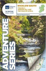
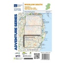
Wandelkaart Adventure Series Wicklow South | Ordnance Survey Ireland (9781908852380)
- ISBN / CODE: 9781908852380
- Editie: 12-11-2018
- Aantal blz.: 1
- Schaal: 1:25000
- Uitgever: Ordnance Survey Ireland
- Soort: Wandelkaart
- Serie: Adventure Series
- Taal: Engels
- Hoogte: 17.0 cm
- Breedte: 12.0 cm
- Uitvoering: Scheur- en watervast
- Bindwijze: -
- Schrijf als eerste een review
-
€ 31,95
Dit artikel is (tijdelijk) niet leverbaar Dit artikel is (tijdelijk) niet leverbaar
- Afbeeldingen
- Inkijkexemplaar
Beschrijving
Van de uitgever
This map is situated in County Wicklow, County Carlow and County Wexford. Roads shown on this map include R752, R753, R747 and R748.
A short portion of the M11 at Arklow is shown. The railway which runs through the Vale of Avoca to Arklow town is shown. Among the towns and villages shown on this map are Avoca, Aughrim, Arklow western section of the town, Hacketstown, Knockananna, Tinahely and Shillelagh.
Mountains and hills that feature are the western part of Croaghanmoira, Cushbawn, Croghan, the southern section of Slieve Maan, Carrickashane, Ballyteige and Stookeen.
Among the rivers on this map are the Ow River, the Aughrim River, the Avoca River, the Derreen River and the Derry River. This map shows the historic site of Avondale House and Forest Park.
The Wicklow Way continues down through the map. Among the many trails, loops and walks marked on this map are Avondale Trails, Avoca Red Kite Trails, Sean Linehan Walk, Ciaran Shannon Walk, Mangans Loop, Ballycumber Loop, Kyle Loop, Tinahely Railway Walk, and Tomnafinnogue.
One Discovery map 1:50,000 sheet 62, also covers this area.
Reviews
Geen reviews gevonden voor dit product.
Schrijf een review
Graag horen wij wat u van dit artikel vindt. Vindt u het goed, leuk, mooi, slecht, lelijk, onbruikbaar of erg handig: schrijf gerust alles op! Het is niet alleen leuk om te doen maar u informeert andere klanten er ook nog mee!
Ook interessant voor europa/ierland/wicklow
-

Wandelgids Irland: Wicklow Way | Con
€ 14,90Wandelgidsen Wicklow - Oost Ierland -

Wandelkaart Adventure Series Wicklow
€ 31,95Wandelkaarten Wicklow - Oost Ierland -

Wegenkaart - landkaart Ireland East
€ 19,50Wegenkaarten Wicklow - Oost Ierland -

Fietsgids Cycling South Dublin & Wic
€ 22,50Fietsgidsen Wicklow - Oost Ierland -

Reisgids PassePartout Ierland Oostku
€ 24,50Reisgidsen Wicklow - Oost Ierland


