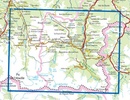
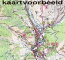
Wandelkaart - Topografische kaart 1848OT Bagnères de Luchon, | IGN - Institut Géographique National (9782758552093)
Lac d'oo
- ISBN / CODE: 9782758552093
- Editie: 16-05-2022
- Druk: 6
- Aantal blz.: 1
- Schaal: 1:25000
- Uitgever: IGN - Institut Géographique National
- Soort: Topografische kaart, Wandelkaart
- Serie: Top 25
- Taal: Frans
- Hoogte: 24.0 cm
- Breedte: 11.0 cm
- Gewicht: 94.0 g
- Uitvoering: Papier
- Bindwijze: -
- Beoordeling: 5,0 ★★★★★ (2 reviews) Schrijf een review
-
€ 16,95
Op voorraad. Voor 17.00 uur op werkdagen besteld, binnen 1 tot 2 werkdagen in huis in Nederland Levertijd Belgie
Gratis verzending in Nederland vanaf €35,-
-
Topografische kaarten IGN 25.000 Pyreneeën : West

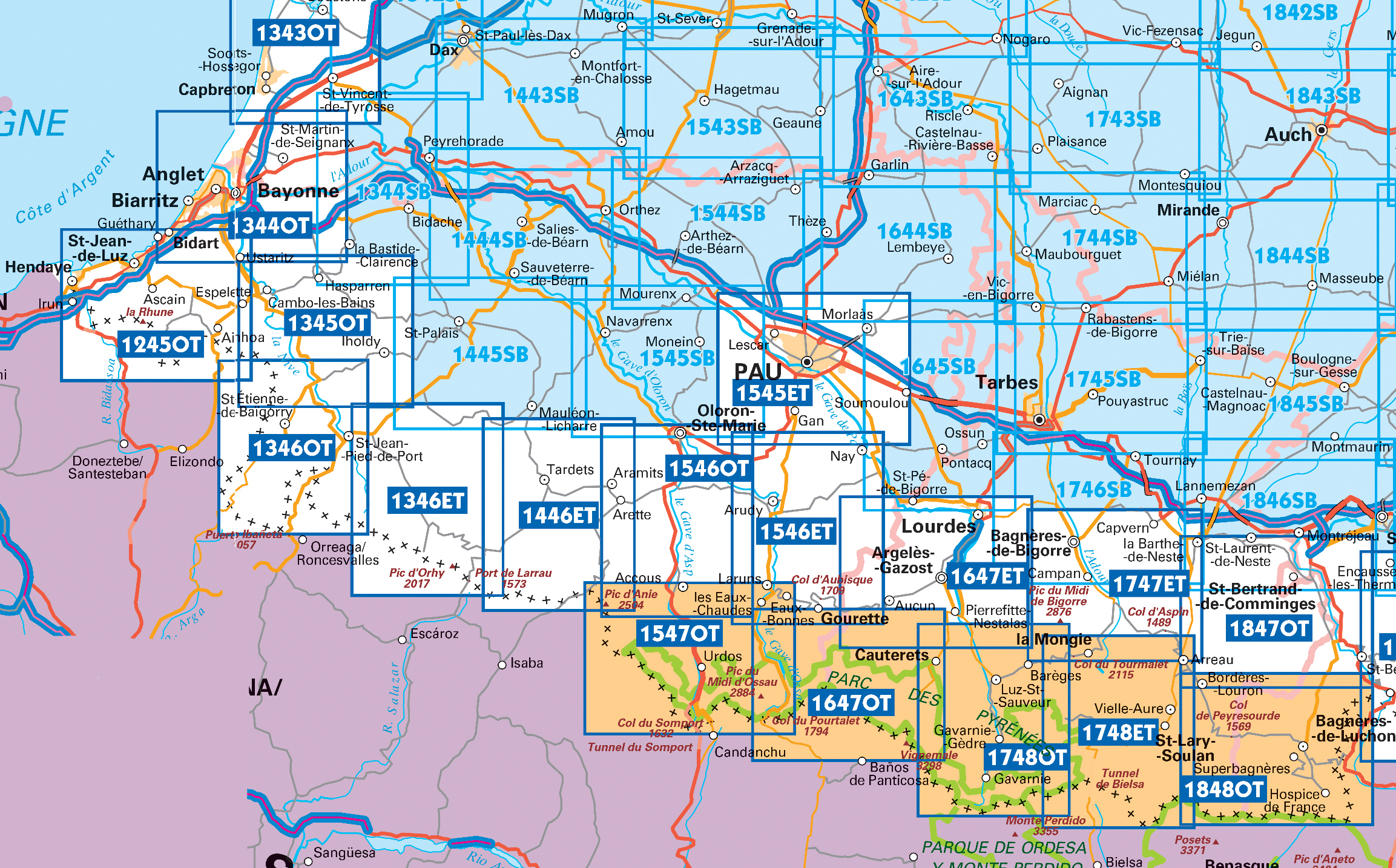
Producten op deze overzichtskaart:
Klik op een product om naar de pagina van dat product te gaan.
- Wandelkaart - Topografische kaart 1245OT Hendaye - St.Jean de Luz - Cote d'Argent | IGN - Institut Géographique National
- Wandelkaart - Topografische kaart 1343E SB - Serie Bleue Saint-Geours-de-Maremne | IGN - Institut Géographique National
- Wandelkaart - Topografische kaart 1344 SB - Serie Bleue Peyrehorade | IGN - Institut Géographique National
- Wandelkaart - Topografische kaart 1344OT Bayonne | IGN - Institut Géographique National
- Wandelkaart - Topografische kaart 1345OT Cambo-les-Bains – Hasparren | IGN - Institut Géographique National
- Topografische kaart - Wandelkaart 1346ET Forêt d'Iraty - Pic d'Orly | IGN - Institut Géographique National
- Topografische kaart - Wandelkaart 1346OT St.-Jean-Pied-de-Port | IGN - Institut Géographique National
- Wandelkaart - Topografische kaart 1444 SB - Serie Bleue Orthez | IGN - Institut Géographique National
- Wandelkaart - Topografische kaart 1445 SB - Serie Bleue Mauléon-Licharre – St-Palais | IGN - Institut Géographique National
- Wandelkaart - Topografische kaart 1446ET Tardets-Sorholus, Arette | IGN - Institut Géographique National
- Wandelkaart - Topografische kaart 1545 SB - Serie Bleue Oloron – Sainte-Marie | IGN - Institut Géographique National
- Wandelkaart - Topografische kaart 1545ET Pau | IGN - Institut Géographique National
- Wandelkaart - Topografische kaart 1546ET Laruns, Gourette | IGN - Institut Géographique National
- Wandelkaart - Topografische kaart 1546OT Oloron-Sainte.Marie, Vallee d'Aspe | IGN - Institut Géographique National
- Wandelkaart - Topografische kaart 1547OT Ossau - Vallée D'Aspe | IGN - Institut Géographique National
- Topografische kaart - Wandelkaart 1645 Pontacq - Ossun - Ger | IGN - Institut Géographique National
- Wandelkaart - Topografische kaart 1647ET Lourdes, Argeles-Gazost, Le Lavedan, Pierrefitte-Nestalas, Aucun | IGN - Institut Géographique National
- Wandelkaart - Topografische kaart 1647OT Vignemale, Ossau, Cauterets, Gourette | IGN - Institut Géographique National
- Wandelkaart - Topografische kaart 1745 SB - Serie Bleue Tarbes | IGN - Institut Géographique National
- Wandelkaart - Topografische kaart 1746 SB - Serie Bleue Bagnères-de-Bigorre | IGN - Institut Géographique National
- Wandelkaart - Topografische kaart 1747ET Bagnères-de-Bigorre | IGN - Institut Géographique National
- Wandelkaart - Topografische kaart 1748ET Neouvielle | IGN - Institut Géographique National
- Wandelkaart - Topografische kaart 1748OT Gavarnie | IGN - Institut Géographique National
- Wandelkaart - Topografische kaart 1845 SB - Serie Bleue Boulogne-sur-Gesse | IGN - Institut Géographique National
- Wandelkaart - Topografische kaart 1846 SB - Serie Bleue Lannemezan | IGN - Institut Géographique National
- Wandelkaart - Topografische kaart 1847OT Saint Bertrand de Comminges, Arreau | IGN - Institut Géographique National
- Wandelkaart - Topografische kaart 1848OT Bagnères de Luchon, | IGN - Institut Géographique National
- Wandelkaart - Topografische kaart 1848OTR Bagnères-de-Luchon | IGN - Institut Géographique National
-
Wandelkaarten IGN 25.000 Pyreneeën : West

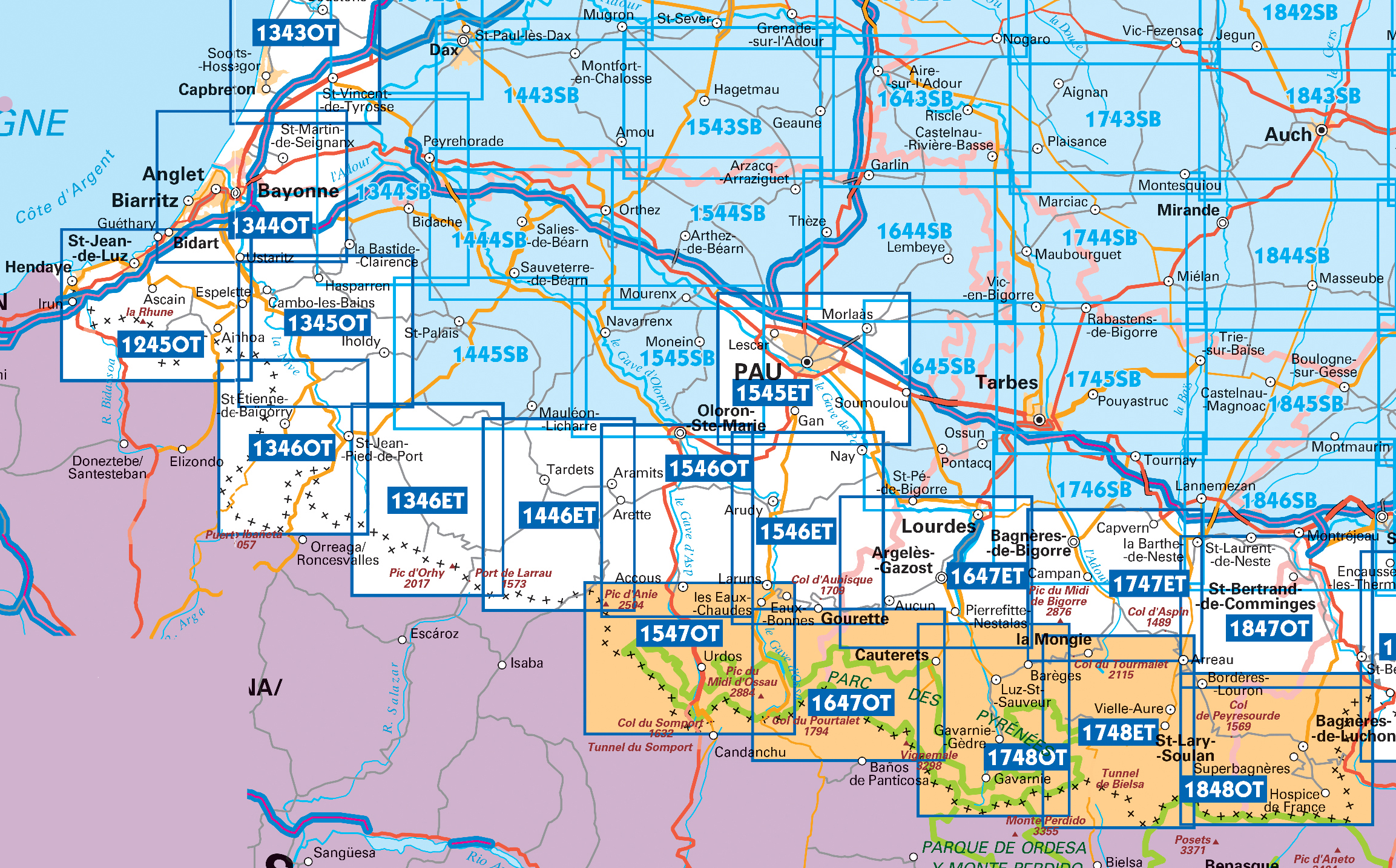
Producten op deze overzichtskaart:
Klik op een product om naar de pagina van dat product te gaan.
- Wandelkaart - Topografische kaart 1245OT Hendaye - St.Jean de Luz - Cote d'Argent | IGN - Institut Géographique National
- Wandelkaart - Topografische kaart 1343E SB - Serie Bleue Saint-Geours-de-Maremne | IGN - Institut Géographique National
- Wandelkaart - Topografische kaart 1344 SB - Serie Bleue Peyrehorade | IGN - Institut Géographique National
- Wandelkaart - Topografische kaart 1344OT Bayonne | IGN - Institut Géographique National
- Wandelkaart - Topografische kaart 1345OT Cambo-les-Bains – Hasparren | IGN - Institut Géographique National
- Topografische kaart - Wandelkaart 1346ET Forêt d'Iraty - Pic d'Orly | IGN - Institut Géographique National
- Topografische kaart - Wandelkaart 1346OT St.-Jean-Pied-de-Port | IGN - Institut Géographique National
- Wandelkaart - Topografische kaart 1444 SB - Serie Bleue Orthez | IGN - Institut Géographique National
- Wandelkaart - Topografische kaart 1445 SB - Serie Bleue Mauléon-Licharre – St-Palais | IGN - Institut Géographique National
- Wandelkaart - Topografische kaart 1446ET Tardets-Sorholus, Arette | IGN - Institut Géographique National
- Wandelkaart - Topografische kaart 1545 SB - Serie Bleue Oloron – Sainte-Marie | IGN - Institut Géographique National
- Wandelkaart - Topografische kaart 1545ET Pau | IGN - Institut Géographique National
- Wandelkaart - Topografische kaart 1546ET Laruns, Gourette | IGN - Institut Géographique National
- Wandelkaart - Topografische kaart 1546OT Oloron-Sainte.Marie, Vallee d'Aspe | IGN - Institut Géographique National
- Wandelkaart - Topografische kaart 1547OT Ossau - Vallée D'Aspe | IGN - Institut Géographique National
- Topografische kaart - Wandelkaart 1645 Pontacq - Ossun - Ger | IGN - Institut Géographique National
- Wandelkaart - Topografische kaart 1647ET Lourdes, Argeles-Gazost, Le Lavedan, Pierrefitte-Nestalas, Aucun | IGN - Institut Géographique National
- Wandelkaart - Topografische kaart 1647OT Vignemale, Ossau, Cauterets, Gourette | IGN - Institut Géographique National
- Wandelkaart - Topografische kaart 1745 SB - Serie Bleue Tarbes | IGN - Institut Géographique National
- Wandelkaart - Topografische kaart 1746 SB - Serie Bleue Bagnères-de-Bigorre | IGN - Institut Géographique National
- Wandelkaart - Topografische kaart 1747ET Bagnères-de-Bigorre | IGN - Institut Géographique National
- Wandelkaart - Topografische kaart 1748ET Neouvielle | IGN - Institut Géographique National
- Wandelkaart - Topografische kaart 1748OT Gavarnie | IGN - Institut Géographique National
- Wandelkaart - Topografische kaart 1845 SB - Serie Bleue Boulogne-sur-Gesse | IGN - Institut Géographique National
- Wandelkaart - Topografische kaart 1846 SB - Serie Bleue Lannemezan | IGN - Institut Géographique National
- Wandelkaart - Topografische kaart 1847OT Saint Bertrand de Comminges, Arreau | IGN - Institut Géographique National
- Wandelkaart - Topografische kaart 1848OT Bagnères de Luchon, | IGN - Institut Géographique National
- Wandelkaart - Topografische kaart 1848OTR Bagnères-de-Luchon | IGN - Institut Géographique National
Overzichtskaarten
Beschrijving
Dit product heeft meerdere varianten:
Reviews
perfecte kaart om te wandelen in de Val Louron
★★★★★ door Bert Damming 27 juli 2023 | Heeft dit artikel gekochtVond u dit een nuttige review? (login om te beoordelen)
Zeer gedetailleerde wandelkaart; is zeer goed bevallen. Afhandeling ook perfect!
★★★★★ door PJ van Egmond 8 september 2012Vond u dit een nuttige review? (login om te beoordelen)
Schrijf een review
Graag horen wij wat u van dit artikel vindt. Vindt u het goed, leuk, mooi, slecht, lelijk, onbruikbaar of erg handig: schrijf gerust alles op! Het is niet alleen leuk om te doen maar u informeert andere klanten er ook nog mee!


