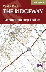
Wandelatlas Ridgeway Map Booklet | Cicerone (9781852849351)
- ISBN / CODE: 9781852849351
- Editie: 21-11-2016
- Druk: 1
- Aantal blz.: 56
- Schaal: 1:25000
- Auteur(s): Steve Davison
- Uitgever: Cicerone
- Soort: Wandelatlas
- Taal: Engels
- Hoogte: 17.0 cm
- Breedte: 11.0 cm
- Gewicht: 71.0 g
- Bindwijze: Paperback
- Uitvoering: -
- Schrijf als eerste een review
-
€ 11,50
Op voorraad. Voor 17.00 uur op werkdagen besteld, binnen 1 tot 2 werkdagen in huis in Nederland Levertijd Belgie
Gratis verzending in Nederland vanaf €35,-
Beschrijving
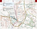
Heel handig bedacht van uitgever Cicerone: een boekje dat dienst doet als atlas met alle topografische kaarten die je nodig hebt voor het lopen van de Ridgeway. Past goed in binnenzak of broekzak.
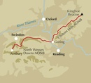
Map of the 87 mile (139km) Ridgeway National Trail through the south of England from Avebury in Wiltshire to Ivinghoe Beacon in Buckinghamshire. This booklet is included with the Cicerone guidebook to the trail, and shows the full route on Ordnance Survey 1:25,000 maps. Presented in 12 stages in the guidebook, the trail typically takes 6-8 days.
Reviews
Geen reviews gevonden voor dit product.
Schrijf een review
Graag horen wij wat u van dit artikel vindt. Vindt u het goed, leuk, mooi, slecht, lelijk, onbruikbaar of erg handig: schrijf gerust alles op! Het is niet alleen leuk om te doen maar u informeert andere klanten er ook nog mee!


