Winkelwagen
Geen items in winkelwagen
Ga naar winkelwagen
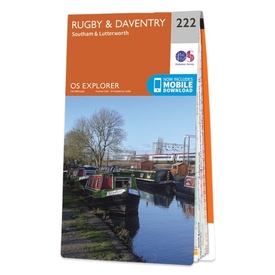
Wandelkaart - Topografische kaart 222 OS Explorer Map Rugby, Daventry | Ordnance Survey (9780319244159)
Southam & Lutterworth
- ISBN / CODE: 9780319244159
- Editie: 2015
- Schaal: 1:25000
- Uitgever: Ordnance Survey
- Soort: Topografische kaart, Wandelkaart
- Serie: OS Explorer Map
- Taal: Engels
- Hoogte: 23.0 cm
- Breedte: 13.0 cm
- Dikte: 1.0 cm
- Gewicht: 150.0 g
- Bindwijze: -
- Uitvoering: Papier
- Schrijf als eerste een review
-
€ 19,50
Dit artikel is (tijdelijk) niet leverbaar
-
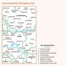
Overzichtskaart Explorer 25.000 topografische kaarten Midden Engeland - Midlands

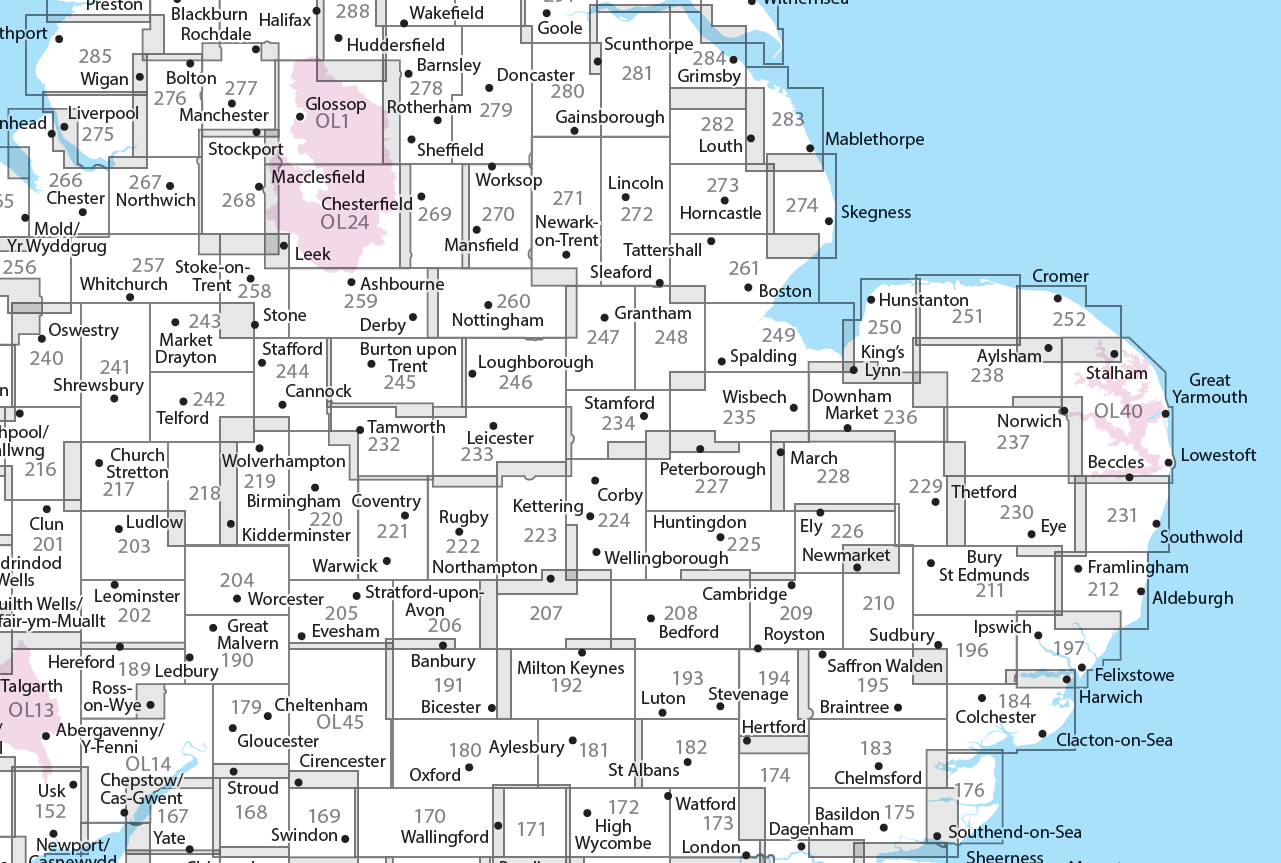
Producten op deze overzichtskaart:
Klik op een product om naar de pagina van dat product te gaan.
- Wandelkaart - Topografische kaart 179 OS Explorer Map Gloucester, Cheltenham, Stroud | Ordnance Survey
- Wandelkaart - Topografische kaart 180 OS Explorer Map Oxford | Ordnance Survey
- Wandelkaart - Topografische kaart 182 OS Explorer Map St-Albans, Hatfield | Ordnance Survey
- Wandelkaart - Topografische kaart 189 OS Explorer Map Hereford & Ross-on-Wye | Ordnance Survey
- Wandelkaart - Topografische kaart 190 OS Explorer Map Malvern Hills, Bredon Hill | Ordnance Survey
- Wandelkaart - Topografische kaart 191 OS Explorer Map Banbury, Bicester, Chipping Norton | Ordnance Survey
- Wandelkaart - Topografische kaart 192 OS Explorer Map Buckingham, Milton Keynes | Ordnance Survey
- Wandelkaart - Topografische kaart 193 OS Explorer Map Luton, Stevenage | Ordnance Survey
- Wandelkaart - Topografische kaart 194 OS Explorer Map Hertford, Bishop's Stortford | Ordnance Survey
- Wandelkaart - Topografische kaart 202 OS Explorer Map Leominster, Bromyard | Ordnance Survey
- Wandelkaart - Topografische kaart 203 OS Explorer Map Ludlow | Ordnance Survey
- Wandelkaart - Topografische kaart 204 OS Explorer Map Worcester, Droitwich Spa | Ordnance Survey
- Wandelkaart - Topografische kaart 205 OS Explorer Map Stratford-upon-Avon, Evesham | Ordnance Survey
- Wandelkaart - Topografische kaart 206 OS Explorer Map Edge Hill, Fenny Compton | Ordnance Survey
- Wandelkaart - Topografische kaart 207 OS Explorer Map Newport Pagnell, Northampton South | Ordnance Survey
- Wandelkaart - Topografische kaart 208 OS Explorer Map Bedford, St Neots | Ordnance Survey
- Wandelkaart - Topografische kaart 209 OS Explorer Map Cambridge (greenw.m) | Ordnance Survey
- Wandelkaart - Topografische kaart 217 OS Explorer Map Long Mynd, Wenlock Edge | Ordnance Survey
- Wandelkaart - Topografische kaart 218 OS Explorer Map Kidderminster, Wyre Forest | Ordnance Survey
- Wandelkaart - Topografische kaart 219 OS Explorer Map Wolverhampton, Dudley | Ordnance Survey
- Wandelkaart - Topografische kaart 220 OS Explorer Map Birmingham | Ordnance Survey
- Wandelkaart - Topografische kaart 221 OS Explorer Map Coventry, Warwick | Ordnance Survey
- Wandelkaart - Topografische kaart 222 OS Explorer Map Rugby, Daventry | Ordnance Survey
- Wandelkaart - Topografische kaart 223 OS Explorer Map Northampton, Market Harborough | Ordnance Survey
- Wandelkaart - Topografische kaart 224 OS Explorer Map Corby, Kettering, Wellingborough | Ordnance Survey
- Wandelkaart - Topografische kaart 225 OS Explorer Map Huntingdon, St Ives | Ordnance Survey
- Wandelkaart - Topografische kaart 227 OS Explorer Map Peterborough, March, Whittlesey, Chatteris, Oundle | Ordnance Survey
- Wandelkaart - Topografische kaart 228 OS Explorer Map March, Ely, Chatteris, Littleport | Ordnance Survey
- Wandelkaart - Topografische kaart 232 OS Explorer Map Nuneaton, Tamworth | Ordnance Survey
- Wandelkaart - Topografische kaart 233 OS Explorer Map Leicester, Hinckley | Ordnance Survey
- Wandelkaart - Topografische kaart 234 OS Explorer Map Rutland Water, Stamford, Oakham | Ordnance Survey
- Wandelkaart - Topografische kaart 235 OS Explorer Map Wisbech, Peterborough North, Market Deeping | Ordnance Survey
- Wandelkaart - Topografische kaart 241 OS Explorer Map Shrewsbury | Ordnance Survey
- Wandelkaart - Topografische kaart 242 OS Explorer Map Telford, Ironbridge, the Wrekin | Ordnance Survey
- Wandelkaart - Topografische kaart 243 OS Explorer Map Market Drayton | Ordnance Survey
- Wandelkaart - Topografische kaart 244 OS Explorer Map Cannock Chase, Chasewater | Ordnance Survey
- Wandelkaart - Topografische kaart 245 OS Explorer Map National Forest | Ordnance Survey
- Wandelkaart - Topografische kaart 246 OS Explorer Map Loughborough | Ordnance Survey
- Wandelkaart - Topografische kaart 247 OS Explorer Map Grantham | Ordnance Survey
- Wandelkaart - Topografische kaart 248 OS Explorer Map Bourne, Heckington | Ordnance Survey
- Wandelkaart - Topografische kaart 249 OS Explorer Map Spalding, Holbeach | Ordnance Survey
- Wandelkaart - Topografische kaart 257 OS Explorer Map Crewe, Nantwich | Ordnance Survey
- Wandelkaart - Topografische kaart 258 OS Explorer Map Stoke-on-Trent, Newcastle-under-Lyme | Ordnance Survey
- Wandelkaart - Topografische kaart 259 OS Explorer Map Derby, Utoxeter | Ordnance Survey
- Wandelkaart - Topografische kaart 260 OS Explorer Map Nottingham | Ordnance Survey
- Wandelkaart - Topografische kaart 261 OS Explorer Map Boston | Ordnance Survey
- Wandelkaart - Topografische kaart 267 OS Explorer Map Northwich & Delamere Forest | Ordnance Survey
- Wandelkaart - Topografische kaart 268 OS Explorer Map Wilmslow, Macclesfield & Congleton | Ordnance Survey
- Wandelkaart - Topografische kaart 269 OS Explorer Map Chesterfield & Alfreton | Ordnance Survey
- Wandelkaart - Topografische kaart 270 OS Explorer Map Sherwood Forest | Ordnance Survey
- Wandelkaart - Topografische kaart 271 OS Explorer Map Newark-on-Trent | Ordnance Survey
- Wandelkaart - Topografische kaart 272 OS Explorer Map Lincoln | Ordnance Survey
- Wandelkaart - Topografische kaart 273 OS Explorer Map Lincolnshire Wolds South | Ordnance Survey
- Wandelkaart - Topografische kaart 274 OS Explorer Map Skegness, Alford & Spilsby | Ordnance Survey
- Wandelkaart - Topografische kaart 275 OS Explorer Map Liverpool St Helens, Widnes & Runcorn | Ordnance Survey
- Wandelkaart - Topografische kaart 276 OS Explorer Map Bolton Central, Wigan & Warrington | Ordnance Survey
- Wandelkaart - Topografische kaart 277 OS Explorer Map Manchester & Salford | Ordnance Survey
- Wandelkaart - Topografische kaart 278 OS Explorer Map Sheffield & Barnsley | Ordnance Survey
- Wandelkaart - Topografische kaart 279 OS Explorer Map Doncaster | Ordnance Survey
- Wandelkaart - Topografische kaart 280 OS Explorer Map Isle of Axholme | Ordnance Survey
- Wandelkaart - Topografische kaart 281 OS Explorer Map Ancholme Valley | Ordnance Survey
- Wandelkaart - Topografische kaart 282 OS Explorer Map Lincolnshire Wolds North | Ordnance Survey
- Wandelkaart - Topografische kaart 283 OS Explorer Map Louth, Mablethorpe | Ordnance Survey
- Wandelkaart - Topografische kaart 284 OS Explorer Map Grimsby, Cleethorpes, Immingham | Ordnance Survey
- Wandelkaart - Topografische kaart OL01 OS Explorer Map The Peak District - Dark Peak Area | Ordnance Survey
- Wandelkaart - Topografische kaart OL14 OS Explorer Map Wye Valley - Forest of Dean - Dyfryn Gwy | Ordnance Survey
- Wandelkaart - Topografische kaart OL24 OS Explorer Map The Peak District - White Peak Area | Ordnance Survey
- Wandelkaart - Topografische kaart OL45 OS Explorer Map The Cotswolds | Ordnance Survey
-
Overzichtskaart Explorer 25.000 wandelkaarten Midden Engeland - Midlands

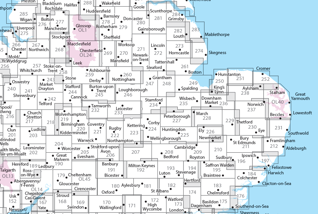
Producten op deze overzichtskaart:
Klik op een product om naar de pagina van dat product te gaan.
- Wandelkaart - Topografische kaart 179 OS Explorer Map Gloucester, Cheltenham, Stroud | Ordnance Survey
- Wandelkaart - Topografische kaart 180 OS Explorer Map Oxford | Ordnance Survey
- Wandelkaart - Topografische kaart 182 OS Explorer Map St-Albans, Hatfield | Ordnance Survey
- Wandelkaart - Topografische kaart 189 OS Explorer Map Hereford & Ross-on-Wye | Ordnance Survey
- Wandelkaart - Topografische kaart 190 OS Explorer Map Malvern Hills, Bredon Hill | Ordnance Survey
- Wandelkaart - Topografische kaart 191 OS Explorer Map Banbury, Bicester, Chipping Norton | Ordnance Survey
- Wandelkaart - Topografische kaart 192 OS Explorer Map Buckingham, Milton Keynes | Ordnance Survey
- Wandelkaart - Topografische kaart 193 OS Explorer Map Luton, Stevenage | Ordnance Survey
- Wandelkaart - Topografische kaart 194 OS Explorer Map Hertford, Bishop's Stortford | Ordnance Survey
- Wandelkaart - Topografische kaart 202 OS Explorer Map Leominster, Bromyard | Ordnance Survey
- Wandelkaart - Topografische kaart 203 OS Explorer Map Ludlow | Ordnance Survey
- Wandelkaart - Topografische kaart 204 OS Explorer Map Worcester, Droitwich Spa | Ordnance Survey
- Wandelkaart - Topografische kaart 205 OS Explorer Map Stratford-upon-Avon, Evesham | Ordnance Survey
- Wandelkaart - Topografische kaart 206 OS Explorer Map Edge Hill, Fenny Compton | Ordnance Survey
- Wandelkaart - Topografische kaart 207 OS Explorer Map Newport Pagnell, Northampton South | Ordnance Survey
- Wandelkaart - Topografische kaart 208 OS Explorer Map Bedford, St Neots | Ordnance Survey
- Wandelkaart - Topografische kaart 209 OS Explorer Map Cambridge (greenw.m) | Ordnance Survey
- Wandelkaart - Topografische kaart 217 OS Explorer Map Long Mynd, Wenlock Edge | Ordnance Survey
- Wandelkaart - Topografische kaart 218 OS Explorer Map Kidderminster, Wyre Forest | Ordnance Survey
- Wandelkaart - Topografische kaart 219 OS Explorer Map Wolverhampton, Dudley | Ordnance Survey
- Wandelkaart - Topografische kaart 220 OS Explorer Map Birmingham | Ordnance Survey
- Wandelkaart - Topografische kaart 221 OS Explorer Map Coventry, Warwick | Ordnance Survey
- Wandelkaart - Topografische kaart 222 OS Explorer Map Rugby, Daventry | Ordnance Survey
- Wandelkaart - Topografische kaart 223 OS Explorer Map Northampton, Market Harborough | Ordnance Survey
- Wandelkaart - Topografische kaart 224 OS Explorer Map Corby, Kettering, Wellingborough | Ordnance Survey
- Wandelkaart - Topografische kaart 225 OS Explorer Map Huntingdon, St Ives | Ordnance Survey
- Wandelkaart - Topografische kaart 227 OS Explorer Map Peterborough, March, Whittlesey, Chatteris, Oundle | Ordnance Survey
- Wandelkaart - Topografische kaart 228 OS Explorer Map March, Ely, Chatteris, Littleport | Ordnance Survey
- Wandelkaart - Topografische kaart 232 OS Explorer Map Nuneaton, Tamworth | Ordnance Survey
- Wandelkaart - Topografische kaart 233 OS Explorer Map Leicester, Hinckley | Ordnance Survey
- Wandelkaart - Topografische kaart 234 OS Explorer Map Rutland Water, Stamford, Oakham | Ordnance Survey
- Wandelkaart - Topografische kaart 235 OS Explorer Map Wisbech, Peterborough North, Market Deeping | Ordnance Survey
- Wandelkaart - Topografische kaart 241 OS Explorer Map Shrewsbury | Ordnance Survey
- Wandelkaart - Topografische kaart 242 OS Explorer Map Telford, Ironbridge, the Wrekin | Ordnance Survey
- Wandelkaart - Topografische kaart 243 OS Explorer Map Market Drayton | Ordnance Survey
- Wandelkaart - Topografische kaart 244 OS Explorer Map Cannock Chase, Chasewater | Ordnance Survey
- Wandelkaart - Topografische kaart 245 OS Explorer Map National Forest | Ordnance Survey
- Wandelkaart - Topografische kaart 246 OS Explorer Map Loughborough | Ordnance Survey
- Wandelkaart - Topografische kaart 247 OS Explorer Map Grantham | Ordnance Survey
- Wandelkaart - Topografische kaart 248 OS Explorer Map Bourne, Heckington | Ordnance Survey
- Wandelkaart - Topografische kaart 249 OS Explorer Map Spalding, Holbeach | Ordnance Survey
- Wandelkaart - Topografische kaart 257 OS Explorer Map Crewe, Nantwich | Ordnance Survey
- Wandelkaart - Topografische kaart 258 OS Explorer Map Stoke-on-Trent, Newcastle-under-Lyme | Ordnance Survey
- Wandelkaart - Topografische kaart 259 OS Explorer Map Derby, Utoxeter | Ordnance Survey
- Wandelkaart - Topografische kaart 260 OS Explorer Map Nottingham | Ordnance Survey
- Wandelkaart - Topografische kaart 261 OS Explorer Map Boston | Ordnance Survey
- Wandelkaart - Topografische kaart 267 OS Explorer Map Northwich & Delamere Forest | Ordnance Survey
- Wandelkaart - Topografische kaart 268 OS Explorer Map Wilmslow, Macclesfield & Congleton | Ordnance Survey
- Wandelkaart - Topografische kaart 269 OS Explorer Map Chesterfield & Alfreton | Ordnance Survey
- Wandelkaart - Topografische kaart 270 OS Explorer Map Sherwood Forest | Ordnance Survey
- Wandelkaart - Topografische kaart 271 OS Explorer Map Newark-on-Trent | Ordnance Survey
- Wandelkaart - Topografische kaart 272 OS Explorer Map Lincoln | Ordnance Survey
- Wandelkaart - Topografische kaart 273 OS Explorer Map Lincolnshire Wolds South | Ordnance Survey
- Wandelkaart - Topografische kaart 274 OS Explorer Map Skegness, Alford & Spilsby | Ordnance Survey
- Wandelkaart - Topografische kaart 275 OS Explorer Map Liverpool St Helens, Widnes & Runcorn | Ordnance Survey
- Wandelkaart - Topografische kaart 276 OS Explorer Map Bolton Central, Wigan & Warrington | Ordnance Survey
- Wandelkaart - Topografische kaart 277 OS Explorer Map Manchester & Salford | Ordnance Survey
- Wandelkaart - Topografische kaart 278 OS Explorer Map Sheffield & Barnsley | Ordnance Survey
- Wandelkaart - Topografische kaart 279 OS Explorer Map Doncaster | Ordnance Survey
- Wandelkaart - Topografische kaart 280 OS Explorer Map Isle of Axholme | Ordnance Survey
- Wandelkaart - Topografische kaart 281 OS Explorer Map Ancholme Valley | Ordnance Survey
- Wandelkaart - Topografische kaart 282 OS Explorer Map Lincolnshire Wolds North | Ordnance Survey
- Wandelkaart - Topografische kaart 283 OS Explorer Map Louth, Mablethorpe | Ordnance Survey
- Wandelkaart - Topografische kaart 284 OS Explorer Map Grimsby, Cleethorpes, Immingham | Ordnance Survey
- Wandelkaart - Topografische kaart OL01 OS Explorer Map The Peak District - Dark Peak Area | Ordnance Survey
- Wandelkaart - Topografische kaart OL14 OS Explorer Map Wye Valley - Forest of Dean - Dyfryn Gwy | Ordnance Survey
- Wandelkaart - Topografische kaart OL24 OS Explorer Map The Peak District - White Peak Area | Ordnance Survey
- Wandelkaart - Topografische kaart OL40 OS Explorer Map The Broads | Ordnance Survey
- Wandelkaart - Topografische kaart OL45 OS Explorer Map The Cotswolds | Ordnance Survey
Overzichtskaarten
Beschrijving
Met zijn 4cm voor 1 km (2 ½ cm voor 1 mijl) schaal, is de OS Explorer kaartenserie de ideale en meest gedetailleerde kaartenreeks voor mensen die graag outdoor-activiteiten zoals fietsen, wandelen, paardrijden, klimmen en watersporten.
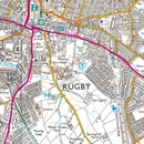
Deze kaart is nog gedetailleerder dan de 'gewone' Landranger maps. Voor- en achterzijde bedrukt! Zeker op de moors en andere natuurgebieden van onschatbare waarden met echt alle aspecten van het landschap op de kaart ingetekend. Zeer goede detailkaart met topografische ondergrond. Hierop zijn toeristische symbolen van bezienswaardigheden ingetekend, daarnaast staan bijvoorbeeld campings en jeugdherbergen vermeld en - voor wandelaars het belangrijkst - alle right of way paden en Lange afstands Wandelpaden zijn er op te vinden. De ideale kaart voor het wandelen in Engeland, Wales of Schotland.
These highly detailed maps show all the administrative boundaries, settlements as small as isolated farms, the road network down to unfenced roads and country tracks, and field boundaries (hedges and drystone walls) which make navigation across the countryside much easier. Steep gradients on roads are indicated. Various landmarks, e.g. powerlines, archaeological sites, windmills, churches and lighthouses are shown and additional graphics indicate natural terrain features such as cliffs, scree, mud and vegetation variations. The contour interval is 5 metres in the lower parts of the country and 10 metres in the uplands, and spot heights are marked. Each map covers an area of 30 x 20km (i.e. approx. 19 x 12 miles), with some double-sided maps covering more, as indicated in the individual descriptions. The maps are fully GPS compatible, with the National Grid shown at 1km intervals and latitude and longitude indicated by margin ticks at 1'.
The Explorer series has replaced the earlier, green-cover Pathfinder maps. The Explorer series is now complete and covers all of England, Wales & Scotland. Some sheets for popular areas like the National Parks are still branded as Outdoor Leisure (OL) maps, but are now included in this series as the cartography is the same as that in the Explorer Maps. The Explorer maps offer a substantial improvement on the Pathfinder series, with greater use of colour, larger area per map, and stronger emphasis on information for ramblers and tourists.
This series is ideal for walking and other outdoor pursuits and each map shows a large amount of information for ramblers and tourists. Public rights of way are shown (except in Scotland), together with other routes with public access: National Trails and Recreational Paths, permitted paths and bridleways, and selected cycle routes. Open access land created under the Countryside and Rights of Way Act 2000 is marked. Tourist information includes caravan and camp sites, Park & Ride locations, recreation/leisure/sport centres, museums, historic buildings, English Heritage and National Trust sites, rural pubs, etc. The map legend is in English only, except for the tourist information content which is also in French and German
Dit product heeft meerdere varianten:


